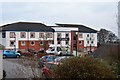
Area Overview for PL6 5XU
Photos of PL6 5XU


Area Information
Living in PL6 5XU means residing within a specific postcode area that covers a small residential cluster in Plymouth, England. This locality hosts a population of 2,805 people packed into a compact space with a density of 1,140 people per square kilometre. The high density suggests a tight-knit environment where daily interactions are common, yet the specific layout of the cluster likely offers defined streets for residents to navigate. You can expect a setting that is neither sprawling nor remote, sitting comfortably within Plymouth's urban fabric. The area functions as a concentrated node of housing where local services are naturally accessible without requiring long commutes. Daily life here revolves around the practicalities of urban living, with the immediate surroundings designed to serve the 2,805 residents efficiently. The residential cluster provides a contained environment where neighbours are often close at hand. For those considering homes in PL6 5XU, the compact nature of the postcode area ensures that essential amenities, schools, and transport links are within practical reach. The definition of a small residential cluster implies a community where the rhythm of life is set by local access rather than distant travel. Whether you are buying a house or renting a flat, the location offers immediate integration into Plymouth's wider network of streets and services. This area represents a straightforward choice for those who value proximity and established access over distant isolation.
- Area Type
- Postcode
- Area Size
- Not available
- Population
- 2805
- Population Density
- 1140 people/km²
Homes in PL6 5XU are primarily structured as houses, a fact supported by the accommodation type data. This differs significantly from areas where apartments or flats dominate, signalling a market geared towards traditional family living or long-stay residents. With 60% home ownership, the market here skews heavily towards owner-occupiers rather than landlords renting to tenants. This high rate of ownership suggests that purchasing a house in this cluster offers security and equity opportunities rather than short-term rental fluctuations. For buyers looking at this small area, the dominance of houses implies you are finding properties with private gardens and standalone structures. This contrasts with high-rise estates found in denser urban cores. The 60% ownership figure indicates that about 40% of households rent, creating a mixed but predominantly private market. This balance often leads to stable neighbourhoods where turnover is lower than in purely rental zones. You will find that the local supply consists mostly of standalone dwellings suited to the 2,805 residents who call PL6 5XU home. The high density of 1,140 people per square kilometre ensures that these houses are grouped closely, creating a defined residential block. This market structure makes the area attractive for those seeking house ownership rather than flat living or seasonal letting arrangements.
House Prices in PL6 5XU
No properties found in this postcode.
Energy Efficiency in PL6 5XU
Daily life in PL6 5XU is conveniently supported by a range of amenities within practical reach. Retail options are strong, with five major shops nearby including M&S Plymouth, M&S Derriford, and Spar Latestop. These venues provide for everyday shopping needs ranging from groceries to larger household goods. For travel, residents have access to two airports listed as Plymouth City Airport, ensuring quick connections beyond the region. Transport networks are further enhanced by five railway stations such as Plymouth Railway Station and St Budeaux Ferry Road Railway Station, facilitating daily commutes across Plymouth and further afield. Connectivity extends to coastal and southern routes via five ferry terminals including Plymouth Ferry Terminal and Plymouth Landing Stage. These facilities open up travel to Port Isaac, Fowey, and other Cornish destinations without leaving Plymouth. The presence of M&S and Spar indicates a well-stocked retail environment where you can sort your weekly provisions locally. The high concentration of transport nodes means that leaving home for work or holidays is straightforward via multiple modes. Whether you prefer walking to a Spar Latestop or catching a train at St Budeaux Victoria Road Railway Station, the lifestyle infrastructure supports easy movement and errands. This amenity-rich setting ensures that residents enjoy a high degree of independence for travel and shopping.
Amenities
Schools
Families living in PL6 5XU have access to a distinct mix of educational institutions nearby. St Matthew's Church of England Primary and Nursery Academy operates as a primary school within the cluster and holds a Good Ofsted rating, meeting the standard expected for primary education. For special educational needs, the Plymouth Hospital & Outreach School is located close by, serving as a vital resource for specific learner groups. Secondary education options include the Plymouth Studio School, which caters to older students requiring alternative or vocational secondary provision. Additionally, individuals attending higher education can utilise the University of St Mark & St John, which functions as an academic facility in the vicinity. This combination of a rated primary academy and various secondary and specialist institutions provides a comprehensive range of options for residents. The presence of an Ofsted-rated good school offers reassurance for parents seeking established educational standards. While there is no comprehensive school listed with a Good rating in the immediate data set, the range of providers ensures that students have access to primary, secondary, and specialist learning pathways. The University of St Mark & St John adds a higher education component, making the area viable for young adults pursuing degrees alongside their local education. The diversity of school types means that children in PL6 5XU face various educational environments depending on their age and specific learning needs.
| Rank | School | Type | Entry gender | Ages |
|---|
Explore more schools in this area
Go to Schools tabDemographics
The community in PL6 5XU is defined by specific demographic markers that shape the local culture and housing needs. The median age is just 22 years, indicating a very young population centre. Despite the low median age, the most common age range consists of adults between 30 and 64 years. This suggests a high proportion of married couples and grown-up households sharing the area, even if the statistical median points to younger residents. Home ownership stands at 60%, a solid majority that implies stability within the neighbourhood. Houses dominate the accommodation type, reflecting a preference for standalone living rather than apartments or shared housing in this cluster. Ethnically, the predominating group is White, which aligns with the broader makeup of much of Plymouth. The area does not focus on luxury or prestige but rather on established residential patterns. The high home ownership rate of 60% often points to a market where local residents have invested locally over time. This contrasts with younger median ages, suggesting that many adults in the 30-64 bracket own their homes while younger families move in. The density of 1,140 people per square kilometre ensures that this community remains active. You will find a mix of families and independent adults who have put down roots in these houses. The demographic profile shows a practical, settled rather than transient population, which is typical for areas with strong home ownership rates.
Household Size
Accommodation Type
Tenure
Ethnic Group
Religion
Household Composition
Age
Household Deprivation
NS-SEC
Explore more demographic insights in this area
Go to Demographics tabPlanning
Planning Constraints
- Flood RiskPremium
- Ramsar Wetland SitesPremium
- Area of Outstanding Natural BeautyPremium
- Protected Nature ReservePremium
- Protected WoodlandPremium