Area Overview for PL6 5EU
Photos of PL6 5EU


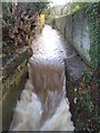


40 photos from this area
Area Information
Key information about the PL6 5EU including its size, population, and administrative classification.
- Area Type
- Postcode
- Area Size
- 1.8 hectares
- Population
- 1775
- Population Density
- 1940 people/km²
House Prices in PL6 5EU
13
Properties
£285,667
Average Sold Price
£198,000
Lowest Price
£420,000
Highest Price
Showing 13 properties
| Address | Type | Beds | Baths | Last Sale Price | Last Sale Date | |
|---|---|---|---|---|---|---|
| Malvern, Tamerton Foliot Road, Plymouth, PL6 5EU | Detached | 3 | 1 | £300,000 | Jan 2021 | |
| Jonnamoran, Tamerton Foliot Road, Plymouth, PL6 5EU | Semi-detached | 2 | 1 | £233,000 | Jan 2021 | |
| Bramcote, Tamerton Foliot Road, Plymouth, PL6 5EU | Bungalow | 2 | 1 | £223,000 | Nov 2020 | |
| Hazelbank, Tamerton Foliot Road, Plymouth, PL6 5EU | Bungalow | 4 | - | £340,000 | Aug 2015 | |
| Charlene, Tamerton Foliot Road, Plymouth, PL6 5EU | Semi-detached | 4 | 2 | £198,000 | Nov 2014 | |
| Brookside, Tamerton Foliot Road, Plymouth, PL6 5EU | Detached | - | - | £420,000 | Aug 2006 | |
| Woodleigh, Tamerton Foliot Road, Plymouth, PL6 5EU | Detached | 5 | 3 | - | - | |
| 137 Tamerton Foliot Road, Plymouth, PL6 5EU | Bungalow | 4 | 3 | - | - | |
| Besamar, Tamerton Foliot Road, Plymouth, PL6 5EU | house | - | - | - | - | |
| Annexe, Pengarth, Tamerton Foliot Road, Plymouth, PL6 5EU | Flat | - | - | - | - |
Page 1 of 2
Energy Efficiency in PL6 5EU
Amenities
Schools
| Rank | School | Type | Entry gender | Ages |
|---|
Explore more schools in this area
Go to Schools tabDemographics
Household Size
Family (3-5 people)
most common
Accommodation Type
Houses
most common
Tenure
53
majority
Ethnic Group
White
most common
Religion
N/A
most common
Household Composition
N/A
most common
Age
47
median
Adults (30-64 years)
most common
Household Deprivation
N/A
with no deprivation
NS-SEC
18
in Lower managerial occupations
Explore more demographic insights in this area
Go to Demographics tabPlanning
Planning Constraints
- Flood RiskPremium
- Ramsar Wetland SitesPremium
- Area of Outstanding Natural BeautyPremium
- Protected Nature ReservePremium
- Protected WoodlandPremium