Area Overview for PL6 5DP
Photos of PL6 5DP


Area Information
Living in PL6 5DP means residing within a compact residential cluster covering just 5,346 square metres in Plymouth, England. This specific postcode area forms a micro-community of 1,957 people who share the benefit of close proximity regardless of their individual street locations. The density here is extremely high relative to the land area, indicating a neighbourhood where every resident is surrounded by others. Being a small residential cluster, PL6 5DP offers a sense of locality that larger districts often dilute. You will find that daily routines are shaped by the intimate scale of this zone, where the boundary between immediate neighbours and the wider local community is fluid. The area serves as a contained pocket of domestic life within the broader Plymouth urban sprawl. You do not need to travel far to reach the heart of your residential surroundings. For families or professionals seeking a defined home territory, PL6 5DP provides a clear physical footprint. The small size of this postcode area ensures that access to nearby landmarks happens quickly. While the area is part of a larger city, the specific cluster maintains its own residential identity. This makes PL6 5DP a distinct choice for those who value a specific, manageable residential zone over a sprawling district.
- Area Type
- Postcode
- Area Size
- 5346 m²
- Population
- 1957
- Population Density
- 2118 people/km²
The property market in PL6 5DP is characterised by a strong presence of owner-occupied housing, with 55% of residents owning their homes. This majority ownership rate distinguishes PL6 5DP from areas dominated by private renting. The predominant accommodation type in the postcode is houses, which shapes the character of the streets and the local environment. You should expect to find detached, semi-detached, or terraced houses rather than purpose-built flats or high-rise apartments. This housing style typically offers more privacy and garden space compared to urban blocks, which aligns with the residential nature of the cluster. Buying a home in PL6 5DP often means entering an established market where owners have planted roots. The high home ownership percentage suggests that transactions may occur more often between sellers who are staying in the area. For buyers seeking houses, PL6 5DP presents a consistent inventory without the mixed-use density found in city centres. The small size of the 5,346 square metre area means that housing stock is limited and likely sells quickly when listed. You need to act decisively because the volume of available properties in such a small residential cluster is naturally constrained. The prevalence of houses also implies a neighbourly dynamic where boundaries and covenants are common features of property agreements.
House Prices in PL6 5DP
Showing 10 properties
| Address | Type | Beds | Baths | Last Sale Price | Last Sale Date | |
|---|---|---|---|---|---|---|
| 1 Lodge Gardens, Plymouth, PL6 5DP | Detached | 4 | 2 | £357,500 | Jan 2025 | |
| 3 Lodge Gardens, Plymouth, PL6 5DP | Detached | 4 | 2 | £270,000 | Sep 2018 | |
| 4 Lodge Gardens, Plymouth, PL6 5DP | Detached | 4 | 2 | £275,000 | Jan 2017 | |
| 6 Lodge Gardens, Plymouth, PL6 5DP | Detached | 4 | - | £273,500 | Jun 2015 | |
| 5 Lodge Gardens, Plymouth, PL6 5DP | Detached | 4 | - | £276,950 | Sep 2010 | |
| 10 Lodge Gardens, Plymouth, PL6 5DP | Detached | - | - | £249,950 | Feb 2007 | |
| 7 Lodge Gardens, Plymouth, PL6 5DP | Detached | - | - | £278,000 | Dec 2006 | |
| 2 Lodge Gardens, Plymouth, PL6 5DP | house | - | - | £114,950 | Nov 1997 | |
| 8 Lodge Gardens, Plymouth, PL6 5DP | Detached | - | - | £99,950 | Dec 1996 | |
| 9 Lodge Gardens, Plymouth, PL6 5DP | Detached | - | - | - | - |
Energy Efficiency in PL6 5DP
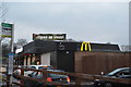
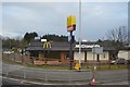
Living in PL6 5DP places you within walking distance or short drive of specific retail and transport hubs. Farmfoods Honicknowle, Co-op Crownhill, and M&S Plymouth are the notable retail outlets available to residents. These venues provide a practical range of groceries and daily essentials without requiring a long journey. You have access to five distinct retail options within the noted amenity list, ensuring convenience for weekly shopping trips. Transport connectivity is enhanced by five nearby rail stations including St Budeaux Ferry Road Railway Station, St Budeaux Victoria Road Railway Station, and Plymouth Railway Station. This rail access connects residents to wider travel networks efficiently. The lifestyle in PL6 5DP is supported by significant transport infrastructure including two airports and five ferry terminals nearby. Plymouth City Airport appears twice in the notable amenities, highlighting its importance for regional travel. You can reach the airport or utilise five different ferry landing stages with ease. Plymouth Landing Stage, Devonport Ferry Terminal, and Plymouth Ferry Terminal offer direct links across the water to Cornwall and other Bristol Channel ports. This density of transport options means PL6 5DP residents enjoy superior mobility for leisure and business alike. The proximity to retail parks and multiple transport hubs creates a convenient baseline for daily life in this residential postcode.
Amenities
Schools
Families considering PL6 5DP must evaluate educational options within reach, although the immediate vicinity of schools in the provided data is limited. Widey High School for Boys is the nearest school identified to this postcode area, listed in the data as a primary institution. This specific naming indicates a local educational facility that serves the community needs of PL6 5DP. You should verify the current Ofsted rating independently as the supply data does not include performance grades. The presence of a primary school suggests that there is educational infrastructure for younger children nearby. The absence of secondary schools in the immediate list for PL6 5DP means that older children may require travel to other zones for upper-secondary education. This is normal for a small residential cluster where primary education often forms the core local offering. Living in PL6 5DP places you within practical reach of Widey High School for Boys for younger dependents. The mix of school types currently confirmed in the data is focused entirely on primary level provision. Families should research bus routes and catchment areas carefully if they need secondary schooling beyond the immediate neighbourhood. The single listed school highlights a specific educational layer available directly to residents of this postcode.
| Rank | School | Type | Entry gender | Ages |
|---|
Explore more schools in this area
Go to Schools tabDemographics
The community of 1,957 people in PL6 5DP has a clearly defined age profile, with a median age of 47 years. Adults aged between 30 and 64 years form the most common age range within this postcode area. This demographic profile suggests that the neighbourhood attracts mature professionals and families rather than students or retirees. You will likely encounter residents who have settled into their careers and are focused on long-term stability. The housing stock reflects this through a predominance of houses rather than flats, which typically suit established households. Home ownership stands at 55%, meaning a majority of residents own their properties outright or with a mortgage while holding title. This significant rate of ownership indicates that PL6 5DP is primarily an owner-occupied area where people invest in their local homes. The population is predominantly White, contributing to a homogeneous community structure. With three-quarters of the population falling into the working-to-retirement age bracket, the daily rhythm of PL6 5DP aligns with standard working hours. This stability supports quiet residential streets where long-term planning is common. The concentration of adults in the prime working years also drives demand for reliable local services and amenities that cater to working families.
Household Size
Accommodation Type
Tenure
Ethnic Group
Religion
Household Composition
Age
Household Deprivation
NS-SEC
Explore more demographic insights in this area
Go to Demographics tabPlanning
Planning Constraints
- Flood RiskPremium
- Ramsar Wetland SitesPremium
- Area of Outstanding Natural BeautyPremium
- Protected Nature ReservePremium
- Protected WoodlandPremium