Area Overview for PL5 3YB
Photos of PL5 3YB


Area Information
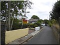
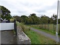
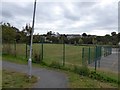
PL5 3YB is a specific residential postcode cluster located in Plymouth, England. It contains a small population of 1,377 people living in a tight-knit community environment. This area functions as a distinct residential pocket within the wider city, offering a quieter end to daily commutes for those settled here. The specific nature of this postcode ensures that residents live in a contained residential neighbourhood rather than a sprawling district. You are looking at a location designed for people who want their property address to be specific and localised within the county. Living in PL5 3YB means accessing the practicalities of city life while maintaining a compact home environment. The area serves as a solid base for households prioritising a defined residential zone. Your daily routine in this cluster will involve navigating established streets without the congestion of larger commercial zones. The setting provides a clear, manageable locality for those seeking a straightforward address in Plymouth.
- Area Type
- Postcode
- Area Size
- Not available
- Population
- 1377
- Population Density
- 4340 people/km²
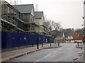
Housing in PL5 3YB consists almost entirely of houses rather than flats or apartments. This stock type caters directly to families and groups seeking single-family homes with gardens or private outdoor space. With 44% of the area classified under home ownership, there is a significant portion of the market featuring residents who have secured their properties permanently. This ownership rate indicates a stable market where sell-throughs may vary compared to high-density rental sectors. Buyers looking at homes in PL5 3YB will primarily encounter detached or semi-detached properties within a small residential cluster. The accommodation type data confirms that you cannot find flats in this specific postcode. This limitation means that investment buyers seeking high-density rental yields will find this area exclusively focused on household ownership of standalone homes. If your target is a larger living space typical of houses, this area delivers that specific requirement. However, potential buyers expecting apartments for singles or couples downsizing will not find them here. The local market is defined by this singular focus on traditional housing stock rather than modern block living.
House Prices in PL5 3YB
No properties found in this postcode.
Energy Efficiency in PL5 3YB
A wide range of amenities lies within practical reach for residents living in PL5 3YB. Five major retailers operate nearby, including Tesco Plymouth, Lidl Honicknowle, and Co-op Whitleigh for your grocery and daily shopping needs. Transport connectivity is robust with five railway stations accessible, such as St Budeaux Ferry Road Railway Station, St Budeaux Victoria Road Railway Station, and Keyham Railway Station for your train journeys. Air travel is supported by two nearby airports, with Plymouth City Airport listed as a key facility for flights. Ferry access connects you to Devonport Ferry Terminal, Torpoint Ferry Terminal, and Plymouth Landing Stage for cross-channel travel. This diversity of options means you can shop, travel by rail, or take a ferry without travelling far. The concentration of five retail outlets and five rail stations ensures convenience is never an issue for your daily schedule. You have immediate access to essential services and regional transport hubs from your doorstep.
Amenities
Schools
| Rank | School | Type | Entry gender | Ages |
|---|
Explore more schools in this area
Go to Schools tabDemographics
The community in PL5 3YB reflects an older demographic with a median age of 47 years. Adults between 30 and 64 years represent the most common age range within this population. This age profile suggests a neighbourhood dominated by established families and semi-working households rather than young professionals or retirees specifically targeting the oldest brackets. Approximately 44% of residents own their homes outright, indicating that just under half the population has achieved full ownership. The remaining households are likely renting or navigating the ladder between rented accommodation and ownership. Houses are the predominant accommodation type found within this postcode cluster, aligning with the preference of the current adult demographic. The population is primarily White, reflecting the traditional ethnic composition of this specific Plymouth locality. You should expect a community where residents have deep roots and stable living arrangements. The age distribution supports a stable environment where long-term residency is the norm for the majority of households settled here.
Household Size
Accommodation Type
Tenure
Ethnic Group
Religion
Household Composition
Age
Household Deprivation
NS-SEC
Explore more demographic insights in this area
Go to Demographics tabPlanning
Planning Constraints
- Flood RiskPremium
- Ramsar Wetland SitesPremium
- Area of Outstanding Natural BeautyPremium
- Protected Nature ReservePremium
- Protected WoodlandPremium