Area Overview for PL5 2LL
Photos of PL5 2LL
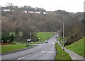
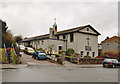
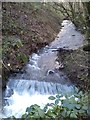

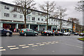
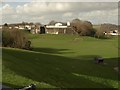
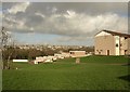
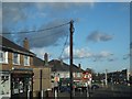
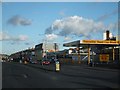
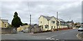
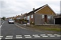
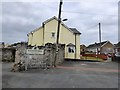
21 photos from this area
Area Information
Key information about the PL5 2LL including its size, population, and administrative classification.
- Area Type
- Postcode
- Area Size
- 9556 m²
- Population
- 1590
- Population Density
- 8590 people/km²
House Prices in PL5 2LL
26
Properties
£166,222
Average Sold Price
£25,000
Lowest Price
£272,000
Highest Price
Showing 26 properties
| Address | Type | Beds | Baths | Last Sale Price | Last Sale Date | |
|---|---|---|---|---|---|---|
| 365 Crownhill Road, Plymouth, PL5 2LL | Semi-detached | 3 | 1 | £270,000 | Nov 2025 | |
| 357 Crownhill Road, Plymouth, PL5 2LL | Semi-detached | 3 | 1 | £239,000 | Mar 2024 | |
| 361 Crownhill Road, Plymouth, PL5 2LL | Semi-detached | 3 | 1 | £272,000 | Jan 2022 | |
| 377 Crownhill Road, Plymouth, PL5 2LL | Semi-detached | 3 | 1 | £195,000 | Aug 2019 | |
| 353 Crownhill Road, Plymouth, PL5 2LL | Semi-detached | 3 | 1 | £190,000 | Aug 2018 | |
| 355 Crownhill Road, Plymouth, PL5 2LL | Semi-detached | 3 | 1 | £150,000 | Nov 2017 | |
| 351 Crownhill Road, Plymouth, PL5 2LL | Semi-detached | 3 | 1 | £185,500 | Oct 2016 | |
| 363 Crownhill Road, Plymouth, PL5 2LL | Semi-detached | - | - | £112,500 | Feb 2016 | |
| 335 Crownhill Road, Plymouth, PL5 2LL | Semi-detached | 3 | - | £193,000 | Oct 2015 | |
| 341 Crownhill Road, Plymouth, PL5 2LL | Semi-detached | 3 | - | £157,000 | May 2015 |
Page 1 of 3
Energy Efficiency in PL5 2LL
Amenities
Schools
| Rank | School | Type | Entry gender | Ages |
|---|
Explore more schools in this area
Go to Schools tabDemographics
Household Size
Family (3-5 people)
most common
Accommodation Type
Houses
most common
Tenure
29
majority
Ethnic Group
White
most common
Religion
N/A
most common
Household Composition
N/A
most common
Age
47
median
Adults (30-64 years)
most common
Household Deprivation
N/A
with no deprivation
NS-SEC
14
in Lower managerial occupations
Explore more demographic insights in this area
Go to Demographics tabPlanning
Planning Constraints
- Flood RiskPremium
- Ramsar Wetland SitesPremium
- Area of Outstanding Natural BeautyPremium
- Protected Nature ReservePremium
- Protected WoodlandPremium