Area Overview for PL5 1LU
Photos of PL5 1LU

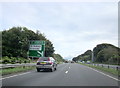
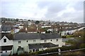
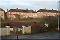
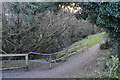
75 photos from this area
Area Information
Key information about the PL5 1LU including its size, population, and administrative classification.
- Area Type
- Postcode
- Area Size
- 2.3 hectares
- Population
- 1578
- Population Density
- 7664 people/km²
House Prices in PL5 1LU
23
Properties
£124,148
Average Sold Price
£46,875
Lowest Price
£198,000
Highest Price
Showing 23 properties
| Address | Type | Beds | Baths | Last Sale Price | Last Sale Date | |
|---|---|---|---|---|---|---|
| 97 Pemros Road, Plymouth, PL5 1LU | Detached | 3 | 1 | £196,500 | Nov 2025 | |
| 123 Pemros Road, Plymouth, PL5 1LU | Semi-detached | 3 | 1 | £130,000 | Jun 2025 | |
| 111 Pemros Road, Plymouth, PL5 1LU | Semi-detached | 3 | 1 | £198,000 | Feb 2022 | |
| 99 Pemros Road, Plymouth, PL5 1LU | Semi-detached | 3 | 1 | £153,000 | Dec 2014 | |
| 115 Pemros Road, Plymouth, PL5 1LU | Semi-detached | - | - | £150,000 | Jul 2008 | |
| 89 Pemros Road, Plymouth, PL5 1LU | Semi-detached | - | - | £140,000 | Sep 2006 | |
| 107 Pemros Road, Plymouth, PL5 1LU | Semi-detached | - | - | £147,950 | Sep 2005 | |
| 121 Pemros Road, Plymouth, PL5 1LU | Semi-detached | 3 | 1 | £127,500 | Apr 2004 | |
| 105 Pemros Road, Plymouth, PL5 1LU | Semi-detached | - | - | £93,000 | Feb 2003 | |
| 103 Pemros Road, Plymouth, PL5 1LU | Semi-detached | - | - | £46,875 | May 2002 |
Page 1 of 3
Energy Efficiency in PL5 1LU
Amenities
Schools
| Rank | School | Type | Entry gender | Ages |
|---|
Explore more schools in this area
Go to Schools tabDemographics
Household Size
Family (3-5 people)
most common
Accommodation Type
Houses
most common
Tenure
51
majority
Ethnic Group
White
most common
Religion
N/A
most common
Household Composition
N/A
most common
Age
47
median
Adults (30-64 years)
most common
Household Deprivation
N/A
with no deprivation
NS-SEC
18
in Lower managerial occupations
Explore more demographic insights in this area
Go to Demographics tabPlanning
Planning Constraints
- Flood RiskPremium
- Ramsar Wetland SitesPremium
- Area of Outstanding Natural BeautyPremium
- Protected Nature ReservePremium
- Protected WoodlandPremium