Area Overview for PL4 8SG
Photos of PL4 8SG
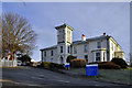
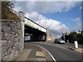
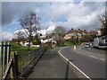
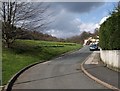
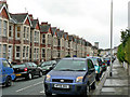
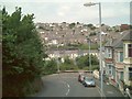
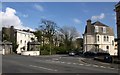
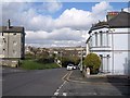
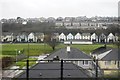
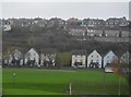
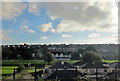
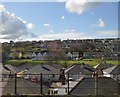
51 photos from this area
Area Information
Key information about the PL4 8SG including its size, population, and administrative classification.
- Area Type
- Postcode
- Area Size
- 5388 m²
- Population
- 1947
- Population Density
- 11006 people/km²
House Prices in PL4 8SG
60
Properties
£163,380
Average Sold Price
£39,000
Lowest Price
£225,000
Highest Price
Showing 60 properties
| Address | Type | Beds | Baths | Last Sale Price | Last Sale Date | |
|---|---|---|---|---|---|---|
| 20 Cecil Avenue, Plymouth, PL4 8SG | Terraced | 3 | 2 | £225,000 | Aug 2024 | |
| 28 Cecil Avenue, Plymouth, PL4 8SG | Flat | - | - | £115,000 | May 2024 | |
| 37 Cecil Avenue, Plymouth, PL4 8SG | Terraced | 3 | 1 | £202,000 | Mar 2024 | |
| 31 Cecil Avenue, Plymouth, PL4 8SG | Flat | 2 | 1 | £115,000 | Oct 2023 | |
| 30 Cecil Avenue, Plymouth, PL4 8SG | house | - | - | £210,000 | Mar 2022 | |
| 29 Cecil Avenue, Plymouth, PL4 8SG | house | - | - | £151,000 | Nov 2021 | |
| 32 Cecil Avenue, Plymouth, PL4 8SG | house | - | - | £209,000 | Nov 2021 | |
| 36 Cecil Avenue, Plymouth, PL4 8SG | house | - | - | £210,000 | Oct 2021 | |
| 40 Cecil Avenue, Plymouth, PL4 8SG | Terraced | 3 | 1 | £210,000 | Sep 2021 | |
| 27 Cecil Avenue, Plymouth, PL4 8SG | house | - | - | £160,000 | Mar 2021 |
Page 1 of 6
Energy Efficiency in PL4 8SG
Amenities
Schools
| Rank | School | Type | Entry gender | Ages |
|---|
Explore more schools in this area
Go to Schools tabDemographics
Household Size
One person
most common
Accommodation Type
Houses
most common
Tenure
43
majority
Ethnic Group
White
most common
Religion
N/A
most common
Household Composition
N/A
most common
Age
47
median
Adults (30-64 years)
most common
Household Deprivation
N/A
with no deprivation
NS-SEC
28
in Lower managerial occupations
Explore more demographic insights in this area
Go to Demographics tabPlanning
Planning Constraints
- Flood RiskPremium
- Ramsar Wetland SitesPremium
- Area of Outstanding Natural BeautyPremium
- Protected Nature ReservePremium
- Protected WoodlandPremium