Area Overview for PL4 8HY
Photos of PL4 8HY
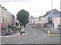
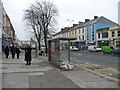
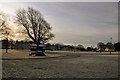
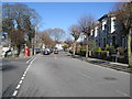
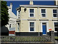
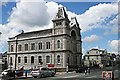
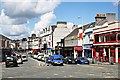
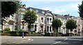
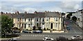
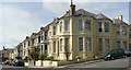
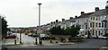
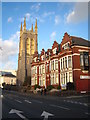
100 photos from this area
Area Information
Key information about the PL4 8HY including its size, population, and administrative classification.
- Area Type
- Postcode
- Area Size
- 3221 m²
- Population
- 1850
- Population Density
- 15533 people/km²
House Prices in PL4 8HY
100
Properties
£219,111
Average Sold Price
£17,500
Lowest Price
£347,000
Highest Price
Showing 100 properties
| Address | Type | Beds | Baths | Last Sale Price | Last Sale Date | |
|---|---|---|---|---|---|---|
| 85 Clifton Place, Plymouth, PL4 8HY | Terraced | 7 | 2 | £280,000 | Feb 2025 | |
| 57 Clifton Place, Plymouth, PL4 8HY | house | 4 | 2 | £200,000 | Jul 2024 | |
| 73 Clifton Place, Plymouth, PL4 8HY | Detached | 7 | 3 | £267,500 | Mar 2024 | |
| 63 Clifton Place, Plymouth, PL4 8HY | Terraced | 7 | 2 | £160,000 | Dec 2023 | |
| 83 Clifton Place, Plymouth, PL4 8HY | Terraced | 3 | 3 | £347,000 | Sep 2022 | |
| 65 Clifton Place, Plymouth, PL4 8HY | house | 7 | 2 | £275,000 | Oct 2021 | |
| 55 Clifton Place, Plymouth, PL4 8HY | Terraced | 8 | 3 | £270,000 | Nov 2019 | |
| 67A Clifton Place, Plymouth, PL4 8HY | Terraced | 1 | 3 | £155,000 | Oct 2018 | |
| 77 Clifton Place, Plymouth, PL4 8HY | Terraced | - | - | £17,500 | Nov 1995 | |
| Flat 1, 87 Clifton Place, Plymouth, PL4 8HY | Flat | 2 | - | - | - |
Page 1 of 10
Energy Efficiency in PL4 8HY
Amenities
Schools
| Rank | School | Type | Entry gender | Ages |
|---|
Explore more schools in this area
Go to Schools tabDemographics
Household Size
One person
most common
Accommodation Type
Flats
most common
Tenure
17
majority
Ethnic Group
White
most common
Religion
N/A
most common
Household Composition
N/A
most common
Age
22
median
Young Adults (15-29 years)
most common
Household Deprivation
N/A
with no deprivation
NS-SEC
17
in Lower managerial occupations
Explore more demographic insights in this area
Go to Demographics tabPlanning
Planning Constraints
- Flood RiskPremium
- Ramsar Wetland SitesPremium
- Area of Outstanding Natural BeautyPremium
- Protected Nature ReservePremium
- Protected WoodlandPremium