Area Overview for PL4 8AN
Photos of PL4 8AN


Area Information
PL4 8AN represents a specific postcode area covering a small residential cluster characterised by a very constrained footprint. The total land mass sits at just 1567 square metres, creating a densely populated urban environment where neighbours are inevitably close by. With a population of 1205 residents, you are moving into a compact setting where local services and daily routes intersect frequently. Living in PL4 8AN means embracing a high-density lifestyle where personal space is limited but community proximity is high. This specific cluster functions as a tightly knit node within the wider Plymouth landscape, offering a distinct experience for those seeking a contained living environment. The sheer concentration of people within such a small physical area dictates a fast-paced daily rhythm. You will find this postcode lacks the sprawling streets of suburban developments, opting instead for a compact living model typical of post-war urban regeneration in Devon. Your days are defined by walking distances to local hubs rather than long drives. The physical boundaries are tight, meaning the character of the street is preserved and easily accessible by pedestrians. For anyone considering homes in this specific cluster, understanding the scale is essential. You are not buying into a neighbourhood with large gardens or quiet cul-de-sacs, but a concentrated residential zone where every square metre is accounted for. This density ensures that local amenities are always within arm's reach, yet it also means you share close quarters with over 700 neighbours on average per hectare.
- Area Type
- Postcode
- Area Size
- 1567 m²
- Population
- 1205
- Population Density
- 13867 people/km²
The property market within PL4 8AN is almost entirely defined by rental dynamics rather than owner-occupier trends. Home ownership stands at a mere 20% of the total population, meaning the remaining 80% reside in rented properties. This imbalance creates a market heavily skewed towards leaseholders, particularly those seeking the flexibility found in flat living. Every home in this postcode is a flat, eliminating the possibility of detached houses, terraced family homes, or bungalows. This uniformity dictates the buyer experience, as prospective purchasers must decide between buying a share of a flat or entering the rental market. With such a small area size of 1567 square metres, the supply of individual homes is inherently limited, driving prices based on location within the cluster rather than land value. The low ownership rate indicates that many residents may move frequently or await a more suitable investment opportunity. You will find very few semi-detached options here. The housing stock is dense and functional, designed to maximise the utility of the available urban space. This configuration suits those entering the property market with a first-time flat purchase or investors targeting the short-term rental sector. The lack of diversity in property types means you cannot mix and match neighbourhood styles; every listing will be an apartment block unit. The high population density further reinforces the rental appeal, as offering a guaranteed return on a small flat is a common strategy in such tight markets.
House Prices in PL4 8AN
Showing 12 properties
Energy Efficiency in PL4 8AN
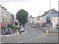
Daily life in PL4 8AN is anchored by a dense cluster of retail and transport amenities within practical walking distance. Residents have access to five retail outlets locally, ensuring groceries and essential goods are always available. Key shopping destinations include Aldi Mount, Spar, and Sainsburys Plymouth, offering comprehensive options for weekly provisioning. Dining and convenience stores are never far away, removing the need for long drives to the city centre. Transport convenience is a defining feature of your lifestyle here. Five railway stations, five ferry terminals, and two airports are all located nearby. You can reach Plymouth Railway Station, the ferry terminal, or the airport with ease depending on your daily rhythm. This connectivity allows you to commute to Exeter or London by rail or take a quick ferry to Devonport for work or leisure. The area also offers frequent ferry services from Plymouth Landing Stage and Plymouth Mount Batten Ferry Landing. Your evenings might involve grabbing coffee at a local Spar or heading straight to the station after work. While the area lacks extensive parks listed in the immediate data, the sheer volume of transport nodes creates a lively, transit-oriented atmosphere. You will find that your weekend plans are often dictated by arrival times at these hubs rather than local leisure venues. The retail presence of Aldi and Sainsburys ensures that practical needs are met instantly without leaving the immediate neighbourhood.
Amenities
Schools
Families considering PL4 8AN have a single primary education option immediately accessible within the vicinity. Mount Street Primary School operates as the closest educational facility for young children in the area. This institution holds an Ofsted rating of good, indicating a standard of education that meets the required benchmarks for the national curriculum. Because the area does not list secondary schools in the immediate vicinity, families must plan for cross-town travel once children reach compulsory secondary age. The mix of school types is limited in this specific postcode, offering only a foundation phase education locally. A school with this rating suggests a stable learning environment, though the proximity to railways and industrial zones may influence transport logistics for school runs. You will need to investigate bus routes to further education centres beyond Mount Street Primary School. The absence of other listed schools means the local ecosystem is focused on early years development. This limitation requires parents to be proactive about securing places at nearby comprehensives further down the road. While the primary option is rated favourably, the lack of a broader school cluster within walking distance remains a practical consideration for all parents living here.
| Rank | School | Type | Entry gender | Ages |
|---|
Explore more schools in this area
Go to Schools tabDemographics
The community profile of PL4 8AN reflects a distinctly youthful population driven by economic demographics rather than family growth. The median age for residents is exactly 22 years, placing the demographic centre firmly within the younger adult bracket. Statistical analysis confirms that the most common age range spans those between 15 and 29 years old. This concentration of young adults suggests a transient yet integrated community focused on early career stages or higher education. Only 20% of residents in this postcode maintain home ownership, indicating that rental accommodation forms the dominant housing arrangement. Consequently, the vast majority of individuals navigating daily life in PL4 8AN are renters or leaseholders. The predominant ethnic group is White, which remains the primary cultural demographic for this specific cluster. You are likely to encounter a crowd mostly under the age of thirty. Housing stock is comprised exclusively of flats, aligning perfectly with the low household ownership rate and the needs of young professionals. This accommodation type supports the high population density figure of 768896 people per square kilometre. Such demographics typically correlate with areas serving university students or young workers devoid of large families. The absence of older residents or children within the standard household definition suggests a lively but potentially less settled neighbourhood. If you are looking for a quiet family enclave with mature occupants, this area does not fit that profile. Instead, it offers a dynamic environment where social life revolves around shared living spaces and proximity to transport links.
Household Size
Accommodation Type
Tenure
Ethnic Group
Religion
Household Composition
Age
Household Deprivation
NS-SEC
Explore more demographic insights in this area
Go to Demographics tabPlanning
Planning Constraints
- Flood RiskPremium
- Ramsar Wetland SitesPremium
- Area of Outstanding Natural BeautyPremium
- Protected Nature ReservePremium
- Protected WoodlandPremium