Area Overview for PL4 7JA
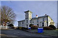
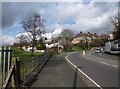
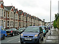
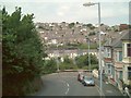
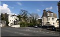
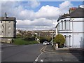
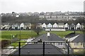
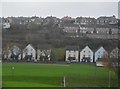
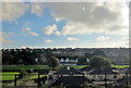
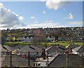
Photos of PL4 7JA


Area Information
PL4 7JA is a small residential cluster covering just 1.5 hectares, home to a population of 1,490 people. This specific postcode area represents a concentrated neighbourhood within the wider Plymouth region. Despite its small footprint, it offers the stability of a defined community where daily life revolves around local connections rather than sprawling suburban distances. The high population density of 102,734 people per square kilometre indicates a tightly knit environment where neighbours are often close by. Living in PL4 7JA means享受着 a setting where space is at a premium but convenience is prioritised. It is an established part of the local fabric, suitable for those who prefer a compact living situation with easy access to wider city amenities. The area functions as a self-contained pocket within Plymouth, offering a balance between residential calm and proximity to major transport links and services found further out.
- Area Type
- Postcode
- Area Size
- 1.5 hectares
- Population
- 1490
- Population Density
- 2796 people/km²
Homes in PL4 7JA are predominantly houses, reflecting the accommodation type recorded for this postcode. With 63% of residents owning their homes, the local market is clearly characterised by owner-occupation rather than private rental demand. This high ownership rate influences the nature of the housing stock, which is built for families and individuals seeking stability rather than short-term tenancy. Buyers looking at this small area can expect to enter a market where properties are held by long-term residents. The limited area size of 1.5 hectares means the total number of homes is finite, creating a competitive but stable environment for purchasers. Property transactions here are likely influenced by the need for families to find space suitable for the adult-centric demographic. There are no flats listed in the data for this specific cluster, so any homebuyer must look exclusively for detached, semi-detached, or terraced houses appropriate for their needs.
House Prices in PL4 7JA
Showing 34 properties
| Address | Type | Beds | Baths | Last Sale Price | Last Sale Date | |
|---|---|---|---|---|---|---|
| Lipson Academy Changing Rooms, Bernice Terrace, Plymouth, PL4 7JA | Leisure | - | - | - | - | |
| 176 Bernice Terrace, Plymouth, PL4 7JA | house | - | - | - | - | |
| 168 Bernice Terrace, Plymouth, PL4 7JA | house | - | - | - | - | |
| 192E Bernice Terrace, Plymouth, PL4 7JA | Flat | - | - | - | - | |
| 154 Bernice Terrace, Plymouth, PL4 7JA | house | - | - | - | - | |
| 158 Bernice Terrace, Plymouth, PL4 7JA | Semi-detached | - | - | - | - | |
| 164 Bernice Terrace, Plymouth, PL4 7JA | Semi-detached | - | - | - | - | |
| 184 Bernice Terrace, Plymouth, PL4 7JA | house | - | - | - | - | |
| 180 Bernice Terrace, Plymouth, PL4 7JA | house | - | - | - | - | |
| 188 Bernice Terrace, Plymouth, PL4 7JA | house | - | - | - | - |
Energy Efficiency in PL4 7JA
Amenities
Schools
Families living in PL4 7JA are well positioned to utilise several educational institutions nearby. Lipson Co-operative Academy operates as an academy and holds a good Ofsted rating, offering secondary-level education with recognised quality standards. For younger children, the area is served by Lipson Vale Primary School, which also carries a good Ofsted rating. Another option is Lipson Community College, which serves as a primary school though specific inspection ratings are not listed in the current records. This mix of primary and academy provision means parents have access to both traditional community-run schools and academy structures. The presence of a good-rated academy suggests a commitment to academic standards in the immediate vicinity. While data on other institutions is absent, these three named schools provide the core educational infrastructure for residents. The variety of school types ensures that different educational philosophies are represented within reach of PL4 7JA homes.
| Rank | School | Type | Entry gender | Ages |
|---|
Explore more schools in this area
Go to Schools tabDemographics
The community in PL4 7JA is defined by a mature profile, with a median age of 47 years. Most residents fall into the adult range between 30 and 64 years old, suggesting a district dominated by established households rather than young families or retirees. Home ownership stands at 63%, indicating that a majority of the population owns their property outright or with a mortgage. This high rate suggests financial stability among residents and a preference for long-term investment. The accommodation type is exclusively houses, meaning you will find no flats within this specific cluster. The predominant ethnic group is White, reflecting a relatively homogenous demographic make-up. Such a community profile implies a neighbourhood where residents have likely lived for significant periods, fostering strong local traditions and established social networks. There is no data provided regarding deprivation levels, but the ownership figures point to a community with substantial financial footing in the local market.
Household Size
Accommodation Type
Tenure
Ethnic Group
Religion
Household Composition
Age
Household Deprivation
NS-SEC
Explore more demographic insights in this area
Go to Demographics tabPlanning
Planning Constraints
- Flood RiskPremium
- Ramsar Wetland SitesPremium
- Area of Outstanding Natural BeautyPremium
- Protected Nature ReservePremium
- Protected WoodlandPremium