Area Overview for PL4 7BL
Photos of PL4 7BL
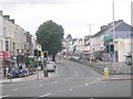
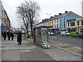

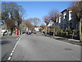
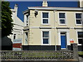
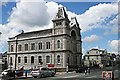
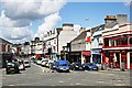
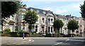
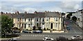
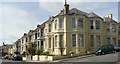
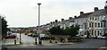
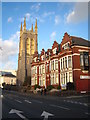
100 photos from this area
Area Information
Key information about the PL4 7BL including its size, population, and administrative classification.
- Area Type
- Postcode
- Area Size
- 4786 m²
- Population
- 1516
- Population Density
- 7197 people/km²
House Prices in PL4 7BL
71
Properties
£143,992
Average Sold Price
£62,725
Lowest Price
£227,500
Highest Price
Showing 71 properties
| Address | Type | Beds | Baths | Last Sale Price | Last Sale Date | |
|---|---|---|---|---|---|---|
| 5 Ashford Road, Plymouth, PL4 7BL | Terraced | 1 | 2 | £227,500 | Dec 2024 | |
| 3 Ashford Road, Plymouth, PL4 7BL | Terraced | 3 | 1 | £210,000 | Jan 2024 | |
| 1B Ashford Road, Plymouth, PL4 7BL | Flat | 2 | 1 | £155,000 | Apr 2022 | |
| 27 Ashford Road, Plymouth, PL4 7BL | Terraced | 2 | 1 | £170,000 | Jul 2021 | |
| 17 Ashford Road, Plymouth, PL4 7BL | Terraced | 6 | 1 | £165,000 | Jan 2020 | |
| 23 Ashford Road, Plymouth, PL4 7BL | Terraced | 5 | 2 | £150,000 | Oct 2019 | |
| 49 Ashford Road, Plymouth, PL4 7BL | Terraced | 3 | 1 | £175,000 | Oct 2019 | |
| 13 Ashford Road, Plymouth, PL4 7BL | Terraced | 4 | 1 | £137,000 | Oct 2016 | |
| 11 Ashford Road, Plymouth, PL4 7BL | house | 5 | 2 | £200,000 | Sep 2016 | |
| 19 Ashford Road, Plymouth, PL4 7BL | Terraced | 3 | - | £152,000 | Aug 2015 |
Page 1 of 8
Energy Efficiency in PL4 7BL
Amenities
Schools
| Rank | School | Type | Entry gender | Ages |
|---|
Explore more schools in this area
Go to Schools tabDemographics
Household Size
One person
most common
Accommodation Type
Houses
most common
Tenure
50
majority
Ethnic Group
White
most common
Religion
N/A
most common
Household Composition
N/A
most common
Age
47
median
Adults (30-64 years)
most common
Household Deprivation
N/A
with no deprivation
NS-SEC
35
in Lower managerial occupations
Explore more demographic insights in this area
Go to Demographics tabPlanning
Planning Constraints
- Flood RiskPremium
- Ramsar Wetland SitesPremium
- Area of Outstanding Natural BeautyPremium
- Protected Nature ReservePremium
- Protected WoodlandPremium