Area Overview for PL35 0AS
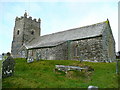
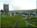
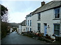
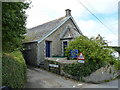
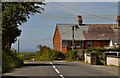
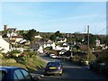
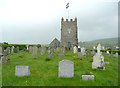
Photos of PL35 0AS


Area Information
PL35 0AS represents a small, defined residential cluster situated within Cambridgeshire. This postcode covers an area of just 9158 square metres, creating a tightly knit environment for its 2249 residents. The low population density of 35 people per square kilometre means streets remain calm and spaces feel open. Living in PL35 0AS offers a sense of quiet that contrasts with nearby urban centres. The layout focuses on housing rather than commercial density, ensuring daily life revolves around the immediate neighbourhood. You will find yourself surrounded by a community where residents know one another. The small footprint means noise does not travel far and light pollution is minimal. This area succeeds by maintaining a private atmosphere without isolation. Prospective buyers appreciate the scarf-like nature of the development amidst the wider countryside. The distinct boundaries provide a clear identity separate from the surrounding villages. It is a place where the coexistence of nature and housing is managed through careful planning constraints. You gain peace of mind knowing that large developments are unlikely to alter the character of this specific postcode in the near future.
- Area Type
- Postcode
- Area Size
- 9158 m²
- Population
- 2249
- Population Density
- 35 people/km²
Homes in PL35 0AS are primarily houses, distinguishing this postcode from urban areas dominated by flats or terraced housing. The 78% home ownership rate signals a market driven by families and long-term owners rather than private landlords. This high ownership percentage often correlates with careful maintenance and a reluctance to move frequently. Buyers looking here should expect a traditional housing stock suited to the local climate and terrain. The small area size of 9158 square metres means supply is limited within the immediate postal zone. You must expand your search slightly to find a wider selection of properties if your absolute requirements are strict. The rental sector appears small relative to the owner-occupied stock. This dynamic stabilises house prices and reduces the risk of sudden vacancy rates disrupting the neighbourhood. Residents benefit from mortgage costs being internalised within household budgets rather than rising rent. The property market here rewards patience and local knowledge over rapid flipping.
House Prices in PL35 0AS
Showing 7 properties
| Address | Type | Beds | Baths | Last Sale Price | Last Sale Date | |
|---|---|---|---|---|---|---|
| Tolcarne Cottage, Doctors Hill, Boscastle, PL35 0AS | Detached | 2 | 1 | £685,000 | Apr 2021 | |
| Greenbank, White Smock Meadow, Boscastle, PL35 0AS | Bungalow | 3 | 2 | - | - | |
| The Willows, White Smock Meadow, Boscastle, PL35 0AS | Bungalow | 3 | 2 | - | - | |
| Owners Accommodation, Boscastle House, Doctors Hill, Boscastle, PL35 0AS | Flat | 9 | - | - | - | |
| Heather Bank, White Smock Meadow, Boscastle, PL35 0AS | Bungalow | - | - | - | - | |
| Wychwood, White Smock Meadow, Boscastle, PL35 0AS | Detached | - | - | - | - | |
| Owners Accommodation, The Old Coach House, Doctors Hill, Boscastle, PL35 0AS | Flat | - | - | - | - |
Energy Efficiency in PL35 0AS
Your daily life in PL35 0AS revolves around a practical set of local amenities clustered within walking or short driving distance. Four retail outlets serve the immediate neighbourhood, with Spar, Spar, and Co-op Camelford being the notable names. Despite the repetition of Spar stores, these convenience shops provide essential groceries and household goods. The presence of a Co-op specifically in Camelford extends your purchasing options slightly beyond the immediate street range. This mix ensures you can buy everyday items without significant travel to town centres. Dining, parks, and large leisure facilities are not explicitly listed in the provided nearest amenities data. You must plan car trips to reach larger supermarkets or entertainment venues. The limited retail count reflects the rural nature of the postcode cluster. Residents appreciate having a local Spar for immediate needs rather than driving to a major town for milk. The selection is functional and focused on necessity.
Amenities
Schools
Boscastle Community Primary School stands as the nearest educational institution to PL35 0AS. It operates as a primary school and holds a 'good' Ofsted rating. This single school serves as the main education hub for children living in and around this specific postcode. The presence of a rated 'good' school provides reassurance for families moving to the area. Since secondary schools are not listed in the provided data for this immediate vicinity, you should plan your travel routes to the nearest comprehensive school early in the buying process. The 'good' rating indicates the school meets high standards for teaching quality and student welfare. Families value the proximity of a primary institution that has demonstrated consistent performance. You will not find a list of academy or faith schools mentioned for this specific cluster in the current records. The single-school option simplifies decision-making for parents whose children are of primary age. For households with older children, checking catchment areas for secondary schools remains a necessary next step despite the strong local primary provision.
| Rank | School | Type | Entry gender | Ages |
|---|
Explore more schools in this area
Go to Schools tabDemographics
The community within PL35 0AS reflects a mature population with a median age of 47 years. Adults between 30 and 64 years represent the most common age range, indicating a stable workforce and families in their prime earning years. This age profile contrasts with student-heavy university towns or retirement-specific developments. The area leans heavily towards owner occupation, with 78% of homes owned outright or with a mortgage. Such high ownership rates suggest long-term residents who have built roots in the location. Houses form the predominant accommodation type, offering space for growing families or those seeking independent living areas. The predominant ethnic group is White, mirroring common patterns across many established English towns. While specific deprivation data is not included in the provided records, the demographic stability points to a settled community. You will likely encounter neighbours who have lived here for decades. The lack of transient populations means local schools and community groups can sustain themselves without constant upheaval. This consistency allows for a reliable social fabric where local issues receive sustained attention from residents.
Household Size
Accommodation Type
Tenure
Ethnic Group
Religion
Household Composition
Age
Household Deprivation
NS-SEC
Explore more demographic insights in this area
Go to Demographics tabPlanning
Planning Constraints
- Flood RiskPremium
- Ramsar Wetland SitesPremium
- Area of Outstanding Natural BeautyPremium
- Protected Nature ReservePremium
- Protected WoodlandPremium