Area Overview for PL34 0BG
Photos of PL34 0BG
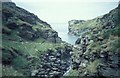
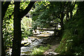
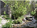
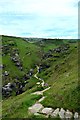

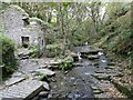
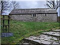
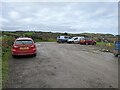
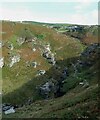
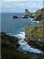
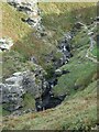
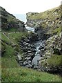
52 photos from this area
Area Information
Key information about the PL34 0BG including its size, population, and administrative classification.
- Area Type
- Postcode
- Area Size
- 53.0 hectares
- Population
- 1488
- Population Density
- 155 people/km²
House Prices in PL34 0BG
49
Properties
£304,716
Average Sold Price
£45,750
Lowest Price
£785,000
Highest Price
Showing 49 properties
| Address | Type | Beds | Baths | Last Sale Price | Last Sale Date | |
|---|---|---|---|---|---|---|
| Mordros, Access To Trethevy, Trethevy, Tintagel, PL34 0BG | Bungalow | 3 | 1 | £100,000 | Jun 2025 | |
| Reevescott, Access To Trethevy, Trethevy, Tintagel, PL34 0BG | Detached | 4 | 4 | £770,000 | Jan 2025 | |
| Tregenna, Access To Trethevy, Trethevy, Tintagel, PL34 0BG | Bungalow | - | - | £350,000 | Jul 2024 | |
| The Haven, Access To Trethevy, Trethevy, Tintagel, PL34 0BG | house | 5 | 4 | £785,000 | Aug 2023 | |
| Westley House, Access To Trethevy, Trethevy, Tintagel, PL34 0BG | Detached | 4 | - | £496,000 | Dec 2020 | |
| Overeven, Access To Trethevy, Trethevy, Tintagel, PL34 0BG | Bungalow | - | - | £258,000 | Oct 2019 | |
| Gwel Teg, Access To Trethevy, Trethevy, Tintagel, PL34 0BG | house | - | - | £181,000 | Sep 2019 | |
| Trebartha, Access To Trethevy, Trethevy, Tintagel, PL34 0BG | house | 4 | - | £475,000 | Apr 2019 | |
| Moppadi, Access To Trethevy, Trethevy, Tintagel, PL34 0BG | Bungalow | 3 | 1 | £240,000 | Dec 2017 | |
| Westaway, Access To Trethevy, Trethevy, Tintagel, PL34 0BG | Detached | 4 | - | £367,000 | Sep 2017 |
Page 1 of 5
Energy Efficiency in PL34 0BG
Amenities
Schools
| Rank | School | Type | Entry gender | Ages |
|---|
Explore more schools in this area
Go to Schools tabDemographics
Household Size
Two person
most common
Accommodation Type
Houses
most common
Tenure
71
majority
Ethnic Group
White
most common
Religion
N/A
most common
Household Composition
N/A
most common
Age
47
median
Adults (30-64 years)
most common
Household Deprivation
N/A
with no deprivation
NS-SEC
28
in Lower managerial occupations
Explore more demographic insights in this area
Go to Demographics tabPlanning
Planning Constraints
- Flood RiskPremium
- Ramsar Wetland SitesPremium
- Area of Outstanding Natural BeautyPremium
- Protected Nature ReservePremium
- Protected WoodlandPremium