Area Overview for PL32 9UF
Photos of PL32 9UF
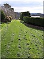
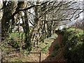
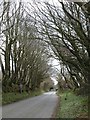
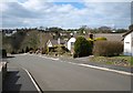
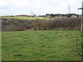
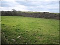
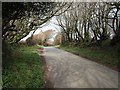
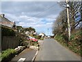
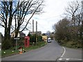
9 photos from this area
Area Information
Key information about the PL32 9UF including its size, population, and administrative classification.
- Area Type
- Postcode
- Area Size
- 16.8 hectares
- Population
- 1833
- Population Density
- 133 people/km²
House Prices in PL32 9UF
20
Properties
£294,385
Average Sold Price
£77,500
Lowest Price
£580,000
Highest Price
Showing 20 properties
| Address | Type | Beds | Baths | Last Sale Price | Last Sale Date | |
|---|---|---|---|---|---|---|
| 26 Mill Lane, Camelford, PL32 9UF | Detached | 4 | 5 | £440,000 | Jan 2025 | |
| The Orchard, Mill Lane, Camelford, PL32 9UF | Bungalow | 2 | 1 | £176,000 | Oct 2023 | |
| Hill View Farm, Mill Lane, Camelford, PL32 9UF | Detached | - | - | £580,000 | Aug 2023 | |
| Menateg, 24 Mill Lane, Camelford, PL32 9UF | Detached | 4 | 3 | £240,000 | May 2020 | |
| The Jaspers, Mill Lane, Camelford, PL32 9UF | Bungalow | 3 | 1 | £225,000 | Jan 2018 | |
| 8 Mill Lane, Camelford, PL32 9UF | Bungalow | 2 | 2 | £400,000 | Jul 2017 | |
| 20 Mill Lane, Camelford, PL32 9UF | Bungalow | 2 | 2 | £313,000 | Aug 2016 | |
| 16 Mill Lane, Camelford, PL32 9UF | Land | 3 | 3 | £352,500 | Aug 2016 | |
| 28 Mill Lane, Camelford, PL32 9UF | Detached | 4 | - | £225,000 | Jan 2013 | |
| The Mowhay, Mill Lane, Camelford, PL32 9UF | Detached | 2 | 2 | £270,000 | Aug 2009 |
Page 1 of 2
Energy Efficiency in PL32 9UF
Amenities
Schools
| Rank | School | Type | Entry gender | Ages |
|---|
Explore more schools in this area
Go to Schools tabDemographics
Household Size
Two person
most common
Accommodation Type
Houses
most common
Tenure
75
majority
Ethnic Group
White
most common
Religion
N/A
most common
Household Composition
N/A
most common
Age
47
median
Adults (30-64 years)
most common
Household Deprivation
N/A
with no deprivation
NS-SEC
29
in Lower managerial occupations
Explore more demographic insights in this area
Go to Demographics tabPlanning
Planning Constraints
- Flood RiskPremium
- Ramsar Wetland SitesPremium
- Area of Outstanding Natural BeautyPremium
- Protected Nature ReservePremium
- Protected WoodlandPremium