Area Overview for PL32 9QT
Photos of PL32 9QT

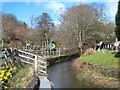
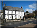
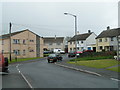
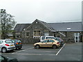
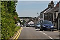
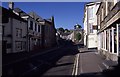
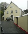
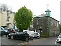
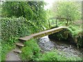
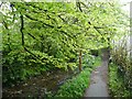
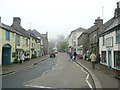
64 photos from this area
Area Information
Key information about the PL32 9QT including its size, population, and administrative classification.
- Area Type
- Postcode
- Area Size
- 3.6 hectares
- Population
- 1546
- Population Density
- 2981 people/km²
House Prices in PL32 9QT
11
Properties
£119,167
Average Sold Price
£67,500
Lowest Price
£205,000
Highest Price
Showing 11 properties
| Address | Type | Beds | Baths | Last Sale Price | Last Sale Date | |
|---|---|---|---|---|---|---|
| Kernyk, Trevia Lane, Camelford, PL32 9QT | Detached | 3 | 1 | £205,000 | Sep 2017 | |
| Shalimar, 1 Sportsmans Road, Camelford, PL32 9QT | Semi-detached | 3 | - | £85,000 | Mar 2001 | |
| 9, Sportsmans, Trevia Lane, Camelford, PL32 9QT | Detached | - | - | £67,500 | Jul 1999 | |
| Meadowcroft, 3 Sportsmans Road, Camelford, PL32 9QT | Semi-detached | 3 | 1 | - | - | |
| Stonecross, Sportsmans, Trevia Lane, Camelford, PL32 9QT | Bungalow | 2 | 2 | - | - | |
| Fairview, Sportsmans, Trevia Lane, Camelford, PL32 9QT | Bungalow | 2 | 2 | - | - | |
| 9A, Trevanerow, Sportsmans, Sportsmans Road, Camelford, PL32 9QT | Bungalow | 3 | 1 | - | - | |
| 5 Sportsmans Road, Camelford, PL32 9QT | Detached | 2 | - | - | - | |
| Aquarius, Sportsmans, Trevia Lane, Camelford, PL32 9QT | house | - | - | - | - | |
| Highfield Dental Practice, 7 Sportsmans Road, Camelford, PL32 9QT | office_workshop | - | - | - | - |
Page 1 of 2
Energy Efficiency in PL32 9QT
Amenities
Schools
| Rank | School | Type | Entry gender | Ages |
|---|
Explore more schools in this area
Go to Schools tabDemographics
Household Size
One person
most common
Accommodation Type
Houses
most common
Tenure
46
majority
Ethnic Group
White
most common
Religion
N/A
most common
Household Composition
N/A
most common
Age
47
median
Adults (30-64 years)
most common
Household Deprivation
N/A
with no deprivation
NS-SEC
22
in Lower managerial occupations
Explore more demographic insights in this area
Go to Demographics tabPlanning
Planning Constraints
- Flood RiskPremium
- Ramsar Wetland SitesPremium
- Area of Outstanding Natural BeautyPremium
- Protected Nature ReservePremium
- Protected WoodlandPremium