Area Overview for PL31 2AE
Photos of PL31 2AE


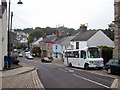
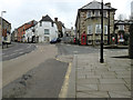

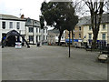
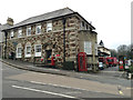
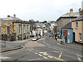
100 photos from this area
Area Information
Key information about the PL31 2AE including its size, population, and administrative classification.
- Area Type
- Postcode
- Area Size
- 5.6 hectares
- Population
- 1932
- Population Density
- 4467 people/km²
House Prices in PL31 2AE
13
Properties
£176,250
Average Sold Price
£142,500
Lowest Price
£210,000
Highest Price
Showing 13 properties
| Address | Type | Beds | Baths | Last Sale Price | Last Sale Date | |
|---|---|---|---|---|---|---|
| The Old Coach House, Priory Road, Bodmin, PL31 2AE | Retail | 2 | - | £210,000 | Aug 2022 | |
| FLAT 9, PRIORY HOUSE, PRIORY ROAD, Bodmin, PL31 2AE | Flat | 2 | 1 | £142,500 | Aug 2021 | |
| Flat 10, Priory House, Priory Road, Bodmin, PL31 2AE | Flat | 3 | 1 | - | - | |
| Flat 3, Priory House, Priory Road, Bodmin, PL31 2AE | Flat | 3 | 2 | - | - | |
| Flat 2, Priory House, Priory Road, Bodmin, PL31 2AE | Flat | 2 | 1 | - | - | |
| Athelstan House, Priory Road, Bodmin, PL31 2AE | Flat | 2 | 1 | - | - | |
| Memory Matters Activity, Narisa Hall, Priory Road, Bodmin, PL31 2AE | commercial | - | - | - | - | |
| Priory Bungalow Annexe, Priory Road, Bodmin, PL31 2AE | Bungalow | - | - | - | - | |
| Bodmin Town Afc Tea Bar, Access To Bodmin Town Afc Social Club, Bodmin, PL31 2AE | Restaurant | - | - | - | - | |
| Flat 7, Priory House, Priory Road, Bodmin, PL31 2AE | Flat | - | - | - | - |
Page 1 of 2
Energy Efficiency in PL31 2AE
Amenities
Schools
| Rank | School | Type | Entry gender | Ages |
|---|
Explore more schools in this area
Go to Schools tabDemographics
Household Size
One person
most common
Accommodation Type
Houses
most common
Tenure
40
majority
Ethnic Group
White
most common
Religion
N/A
most common
Household Composition
N/A
most common
Age
47
median
Adults (30-64 years)
most common
Household Deprivation
N/A
with no deprivation
NS-SEC
21
in Lower managerial occupations
Explore more demographic insights in this area
Go to Demographics tabPlanning
Planning Constraints
- Flood RiskPremium
- Ramsar Wetland SitesPremium
- Area of Outstanding Natural BeautyPremium
- Protected Nature ReservePremium
- Protected WoodlandPremium