Area Overview for PL31 1NH
Photos of PL31 1NH
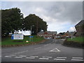
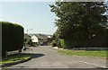
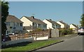
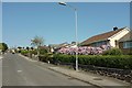
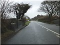
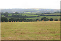
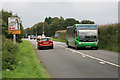
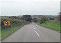
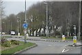
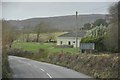
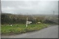
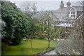
19 photos from this area
Area Information
Key information about the PL31 1NH including its size, population, and administrative classification.
- Area Type
- Postcode
- Area Size
- 1.3 hectares
- Population
- 1096
- Population Density
- 1045 people/km²
House Prices in PL31 1NH
25
Properties
£173,910
Average Sold Price
£56,500
Lowest Price
£323,000
Highest Price
Showing 25 properties
| Address | Type | Beds | Baths | Last Sale Price | Last Sale Date | |
|---|---|---|---|---|---|---|
| 133 St Marys Road, Bodmin, PL31 1NH | Detached | 3 | 1 | £195,250 | Dec 2025 | |
| 131 St Marys Road, Bodmin, PL31 1NH | Detached | 3 | 1 | £195,000 | Aug 2025 | |
| 117 St Marys Road, Bodmin, PL31 1NH | Bungalow | 3 | 1 | £323,000 | Jun 2024 | |
| 129 St Marys Road, Bodmin, PL31 1NH | house | 3 | 2 | £267,000 | Dec 2022 | |
| 101 St Marys Road, Bodmin, PL31 1NH | Bungalow | 3 | - | £252,000 | Feb 2021 | |
| 113 St Marys Road, Bodmin, PL31 1NH | Bungalow | 2 | 2 | £205,000 | Apr 2017 | |
| 139 St Marys Road, Bodmin, PL31 1NH | house | 3 | - | £159,950 | Aug 2016 | |
| 141 St Marys Road, Bodmin, PL31 1NH | Semi-detached | 4 | - | £159,950 | May 2014 | |
| 107 St Marys Road, Bodmin, PL31 1NH | Bungalow | 3 | - | £235,000 | Jan 2012 | |
| 95 St Marys Road, Bodmin, PL31 1NH | Bungalow | - | - | £172,000 | Jun 2011 |
Page 1 of 3
Energy Efficiency in PL31 1NH
Amenities
Schools
| Rank | School | Type | Entry gender | Ages |
|---|
Explore more schools in this area
Go to Schools tabDemographics
Household Size
Two person
most common
Accommodation Type
Houses
most common
Tenure
80
majority
Ethnic Group
White
most common
Religion
N/A
most common
Household Composition
N/A
most common
Age
47
median
Adults (30-64 years)
most common
Household Deprivation
N/A
with no deprivation
NS-SEC
22
in Lower managerial occupations
Explore more demographic insights in this area
Go to Demographics tabPlanning
Planning Constraints
- Flood RiskPremium
- Ramsar Wetland SitesPremium
- Area of Outstanding Natural BeautyPremium
- Protected Nature ReservePremium
- Protected WoodlandPremium