Area Overview for PL3 6LN
Photos of PL3 6LN
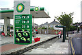
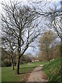
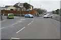
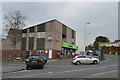

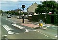
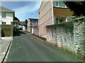
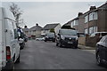
24 photos from this area
Area Information
Key information about the PL3 6LN including its size, population, and administrative classification.
- Area Type
- Postcode
- Area Size
- 7461 m²
- Population
- 1602
- Population Density
- 4630 people/km²
House Prices in PL3 6LN
30
Properties
£114,813
Average Sold Price
£31,625
Lowest Price
£177,500
Highest Price
Showing 30 properties
| Address | Type | Beds | Baths | Last Sale Price | Last Sale Date | |
|---|---|---|---|---|---|---|
| 149 Channel Park Avenue, Plymouth, PL3 6LN | house | - | - | £154,000 | Sep 2025 | |
| 137 Channel Park Avenue, Plymouth, PL3 6LN | Semi-detached | 2 | 1 | £148,500 | Jul 2025 | |
| 155 Channel Park Avenue, Plymouth, PL3 6LN | Semi-detached | 2 | 1 | £177,500 | Oct 2024 | |
| 135 Channel Park Avenue, Plymouth, PL3 6LN | Semi-detached | 2 | 1 | £165,000 | Apr 2022 | |
| 147 Channel Park Avenue, Plymouth, PL3 6LN | house | - | - | £80,000 | Apr 2019 | |
| 150 Channel Park Avenue, Plymouth, PL3 6LN | house | - | - | £95,000 | Jul 2009 | |
| 143 Channel Park Avenue, Plymouth, PL3 6LN | Semi-detached | - | - | £82,500 | Dec 2007 | |
| 146 Channel Park Avenue, Plymouth, PL3 6LN | Semi-detached | - | - | £122,500 | Aug 2007 | |
| 130 Channel Park Avenue, Plymouth, PL3 6LN | Semi-detached | - | - | £91,500 | Jan 2006 | |
| 129 Channel Park Avenue, Plymouth, PL3 6LN | Semi-detached | - | - | £31,625 | Nov 2002 |
Page 1 of 3
Energy Efficiency in PL3 6LN
Amenities
Schools
| Rank | School | Type | Entry gender | Ages |
|---|
Explore more schools in this area
Go to Schools tabDemographics
Household Size
Family (3-5 people)
most common
Accommodation Type
Houses
most common
Tenure
42
majority
Ethnic Group
White
most common
Religion
N/A
most common
Household Composition
N/A
most common
Age
47
median
Adults (30-64 years)
most common
Household Deprivation
N/A
with no deprivation
NS-SEC
18
in Lower managerial occupations
Explore more demographic insights in this area
Go to Demographics tabPlanning
Planning Constraints
- Flood RiskPremium
- Ramsar Wetland SitesPremium
- Area of Outstanding Natural BeautyPremium
- Protected Nature ReservePremium
- Protected WoodlandPremium