Area Overview for PL3 6JJ
Photos of PL3 6JJ
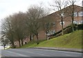
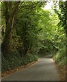
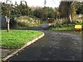
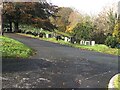
18 photos from this area
Area Information
Key information about the PL3 6JJ including its size, population, and administrative classification.
- Area Type
- Postcode
- Area Size
- 2.8 hectares
- Population
- 1686
- Population Density
- 7629 people/km²
House Prices in PL3 6JJ
45
Properties
£128,548
Average Sold Price
£35,500
Lowest Price
£210,000
Highest Price
Showing 45 properties
| Address | Type | Beds | Baths | Last Sale Price | Last Sale Date | |
|---|---|---|---|---|---|---|
| 76 Severn Place, Plymouth, PL3 6JJ | Semi-detached | 3 | 1 | £186,000 | Feb 2025 | |
| 74 Severn Place, Plymouth, PL3 6JJ | Semi-detached | 3 | 1 | £205,000 | Nov 2024 | |
| 48 Severn Place, Plymouth, PL3 6JJ | Semi-detached | 3 | 1 | £180,000 | Nov 2024 | |
| 70 Severn Place, Plymouth, PL3 6JJ | Terraced | 3 | 1 | £210,000 | Jan 2023 | |
| 61 Severn Place, Plymouth, PL3 6JJ | Retail | 3 | 1 | £205,000 | Feb 2022 | |
| 94 Severn Place, Plymouth, PL3 6JJ | Semi-detached | - | - | £125,000 | Mar 2021 | |
| 44 Severn Place, Plymouth, PL3 6JJ | Semi-detached | 3 | 1 | £185,000 | Aug 2020 | |
| 50 Severn Place, Plymouth, PL3 6JJ | Semi-detached | 3 | 1 | £160,000 | Jul 2018 | |
| 92 Severn Place, Plymouth, PL3 6JJ | Semi-detached | 3 | 1 | £153,000 | Jan 2018 | |
| 86 Severn Place, Plymouth, PL3 6JJ | Semi-detached | 3 | 1 | £150,000 | Apr 2017 |
Page 1 of 5
Energy Efficiency in PL3 6JJ
Amenities
Schools
| Rank | School | Type | Entry gender | Ages |
|---|
Explore more schools in this area
Go to Schools tabDemographics
Household Size
One person
most common
Accommodation Type
Houses
most common
Tenure
43
majority
Ethnic Group
White
most common
Religion
N/A
most common
Household Composition
N/A
most common
Age
47
median
Adults (30-64 years)
most common
Household Deprivation
N/A
with no deprivation
NS-SEC
17
in Lower managerial occupations
Explore more demographic insights in this area
Go to Demographics tabPlanning
Planning Constraints
- Flood RiskPremium
- Ramsar Wetland SitesPremium
- Area of Outstanding Natural BeautyPremium
- Protected Nature ReservePremium
- Protected WoodlandPremium