Area Overview for PL3 6BW
Photos of PL3 6BW
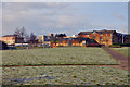
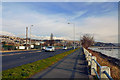
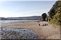
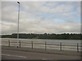

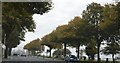
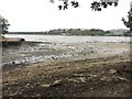
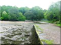
94 photos from this area
Area Information
Key information about the PL3 6BW including its size, population, and administrative classification.
- Area Type
- Postcode
- Area Size
- 6705 m²
- Population
- 1527
- Population Density
- 7210 people/km²
House Prices in PL3 6BW
30
Properties
£128,558
Average Sold Price
£37,950
Lowest Price
£226,000
Highest Price
Showing 30 properties
| Address | Type | Beds | Baths | Last Sale Price | Last Sale Date | |
|---|---|---|---|---|---|---|
| 235 Old Laira Road, Plymouth, PL3 6BW | Terraced | 2 | 1 | £155,000 | Jul 2025 | |
| 199 Old Laira Road, Plymouth, PL3 6BW | Terraced | 3 | 1 | £226,000 | Jun 2025 | |
| 203 Old Laira Road, Plymouth, PL3 6BW | Terraced | 3 | 1 | £199,000 | May 2023 | |
| 213 Old Laira Road, Plymouth, PL3 6BW | house | - | - | £177,500 | Sep 2021 | |
| 191 Old Laira Road, Plymouth, PL3 6BW | Terraced | 3 | 1 | £157,000 | Jul 2019 | |
| 217 Old Laira Road, Plymouth, PL3 6BW | Terraced | 2 | 1 | £170,000 | Dec 2018 | |
| 219 Old Laira Road, Plymouth, PL3 6BW | Terraced | 3 | 1 | £154,950 | Apr 2017 | |
| 189 Old Laira Road, Plymouth, PL3 6BW | Terraced | 3 | 1 | £125,000 | Jul 2016 | |
| 231 Old Laira Road, Plymouth, PL3 6BW | Terraced | 2 | - | £117,000 | Sep 2015 | |
| 205 Old Laira Road, Plymouth, PL3 6BW | Terraced | 3 | 1 | £136,950 | Jul 2014 |
Page 1 of 3
Energy Efficiency in PL3 6BW
Amenities
Schools
| Rank | School | Type | Entry gender | Ages |
|---|
Explore more schools in this area
Go to Schools tabDemographics
Household Size
Two person
most common
Accommodation Type
Houses
most common
Tenure
65
majority
Ethnic Group
White
most common
Religion
N/A
most common
Household Composition
N/A
most common
Age
47
median
Adults (30-64 years)
most common
Household Deprivation
N/A
with no deprivation
NS-SEC
22
in Lower managerial occupations
Explore more demographic insights in this area
Go to Demographics tabPlanning
Planning Constraints
- Flood RiskPremium
- Ramsar Wetland SitesPremium
- Area of Outstanding Natural BeautyPremium
- Protected Nature ReservePremium
- Protected WoodlandPremium