Area Overview for PL3 5SE
Photos of PL3 5SE
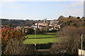
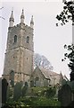
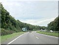
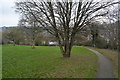
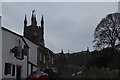
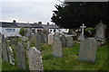
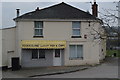
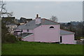
34 photos from this area
Area Information
Key information about the PL3 5SE including its size, population, and administrative classification.
- Area Type
- Postcode
- Area Size
- 4.6 hectares
- Population
- 1560
- Population Density
- 3849 people/km²
House Prices in PL3 5SE
30
Properties
£252,597
Average Sold Price
£80,000
Lowest Price
£425,000
Highest Price
Showing 30 properties
| Address | Type | Beds | Baths | Last Sale Price | Last Sale Date | |
|---|---|---|---|---|---|---|
| 132 Beaumaris Road, Plymouth, PL3 5SE | house | 4 | 1 | £365,000 | Aug 2024 | |
| 138 Beaumaris Road, Plymouth, PL3 5SE | Detached | 4 | 2 | £400,000 | Sep 2022 | |
| 150 Beaumaris Road, Plymouth, PL3 5SE | Detached | 4 | 1 | £340,000 | Jul 2022 | |
| 172 Beaumaris Road, Plymouth, PL3 5SE | house | - | - | £325,000 | Jun 2020 | |
| 186 Beaumaris Road, Plymouth, PL3 5SE | Detached | 5 | 3 | £425,000 | Aug 2017 | |
| 124 Beaumaris Road, Plymouth, PL3 5SE | Detached | 3 | 1 | £230,000 | Jul 2017 | |
| 148 Beaumaris Road, Plymouth, PL3 5SE | Detached | 5 | 1 | £295,000 | Oct 2014 | |
| 146 Beaumaris Road, Plymouth, PL3 5SE | house | - | - | £250,000 | Aug 2014 | |
| 164 Beaumaris Road, Plymouth, PL3 5SE | house | 4 | - | £248,000 | Dec 2011 | |
| 180 Beaumaris Road, Plymouth, PL3 5SE | house | - | - | £334,000 | Apr 2011 |
Page 1 of 3
Energy Efficiency in PL3 5SE
Amenities
Schools
| Rank | School | Type | Entry gender | Ages |
|---|
Explore more schools in this area
Go to Schools tabDemographics
Household Size
Two person
most common
Accommodation Type
Houses
most common
Tenure
88
majority
Ethnic Group
White
most common
Religion
N/A
most common
Household Composition
N/A
most common
Age
47
median
Adults (30-64 years)
most common
Household Deprivation
N/A
with no deprivation
NS-SEC
39
in Lower managerial occupations
Explore more demographic insights in this area
Go to Demographics tabPlanning
Planning Constraints
- Flood RiskPremium
- Ramsar Wetland SitesPremium
- Area of Outstanding Natural BeautyPremium
- Protected Nature ReservePremium
- Protected WoodlandPremium