Area Overview for PL3 5LD
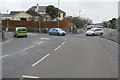
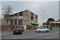
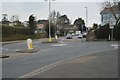
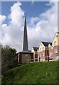
Photos of PL3 5LD


Area Information
Living in PL3 5LD means residing within a tightly clustered residential zone in Plymouth, England. This specific postcode covers 4,888 square metres and houses a population of 1,438 people. The density here reaches 294,183 people per square kilometre, indicating a concentrated community where properties are close to one another. Prospective buyers should understand that you are entering a small, defined neighbourhood rather than a sprawling district. The area forms a distinct pocket within the wider city, offering a sense of locality while remaining connected to broader Plymouth. Residents here benefit from being on the ground floor of the city's activity without living in the absolute centre. This postcode represents a micro-community where daily routines are shaped by immediate local infrastructure. You will find yourself surrounded by neighbours in a setting that prioritises proximity. The small physical footprint means that local developments happen quickly and directly impact every resident. It is a practical choice for those who value a contained living environment over expansive green space. Your time in PL3 5LD is defined by this high density and the efficiency of a compact location. You trade wide open views for a situated sense of belonging within the city fabric. Every street in this small cluster connects to the larger network of Plymouth services and transport routes.
- Area Type
- Postcode
- Area Size
- 4888 m²
- Population
- 1438
- Population Density
- 4926 people/km²
The property market in PL3 5LD is defined by its exclusive focus on houses and high owner occupation. Every single property in this postcode falls under the accommodation type of houses, meaning you will not find flats or apartments listed for this specific cluster. The home ownership level of 87% confirms that the vast majority of these homes are privately owned by their residents. This market dynamic suggests a stable environment where price fluctuations are driven by owner decisions rather than rental demand cycles. Buyers looking at PL3 5LD are entering a traditional housing stock designed for family living or independent residential use. The absence of rental sector dominance means that maintenance and improvements tend to remain in the hands of local owners. This creates a community where houses are treated as long-term assets rather than short-term tenancies. You will find that the local estate market responds slowly, as owners are often reluctant to sell. The 87% ownership figure stands as a testament to the area's appeal to permanent residents across the Devonport and Compton regions. Potential buyers should prepare for a market where negotiation happens between owners who value their properties deeply. The uniformity of the housing stock means that renovation and extension options are consistent across the postcode. This solid foundation makes PL3 5LD a predictable choice for those seeking a house with an owner-crewed street.
House Prices in PL3 5LD
Showing 6 properties
| Address | Type | Beds | Baths | Last Sale Price | Last Sale Date | |
|---|---|---|---|---|---|---|
| 3 Brynmoor Walk, Plymouth, PL3 5LD | Bungalow | 3 | 1 | £390,000 | Jul 2024 | |
| 1 Brynmoor Walk, Plymouth, PL3 5LD | Bungalow | 2 | 1 | £360,000 | Dec 2023 | |
| 4 Brynmoor Walk, Plymouth, PL3 5LD | house | 3 | - | £300,000 | Mar 2021 | |
| 5 Brynmoor Walk, Plymouth, PL3 5LD | Bungalow | 3 | 2 | £190,000 | Aug 2013 | |
| 2 Brynmoor Walk, Plymouth, PL3 5LD | Detached | - | - | £195,000 | Nov 2008 | |
| 6 Brynmoor Walk, Plymouth, PL3 5LD | Detached | - | - | - | - |
Energy Efficiency in PL3 5LD
Residents of PL3 5LD enjoy immediate access to a variety of retail and transport amenities within practical reach. For shopping needs, you are close to Tesco Compton, Co-op Higher, and Co-op Plymouth, providing plenty of grocery and daily household options. If commuting is part of your routine, five rail stations including Plymouth Railway Station, Devonport Railway Station, and Dockyard Railway Station offer frequent connections across the region. Ferry services are also accessible with terminals at Plymouth Mount Batten Ferry Landing and Plymouth Ferry Terminal, linking you to other coastal towns. Two airports serve the area, notably Plymouth City Airport, which provides flight options for leisure and business travel. This range of transport modes gives you flexibility in how you move around England. The presence of ten distinct named transport and retail venues ensures daily errands and weekly trips are convenient. You never have to travel far for a supermarket ticket or a train departure. The layout of these amenities around PL3 5LD creates a balanced lifestyle where work, leisure, and shopping fit into a single day. Residents can choose to walk to these services or use the extensive public transport network available to them.
Amenities
Schools
Families considering homes in PL3 5LD have Burleigh County Secondary School as their primary educational option nearby. This secondary institution serves students in the older age brackets and is a key part of the local educational landscape. While PL3 5LD itself is a small residential cluster, the presence of this named school provides certainty for parents regarding educational provision. The school type is secondary, indicating that it caters to students in the later stages of compulsory education. You should verify the specific Ofsted rating through official government channels when evaluating the school further, as the current data only confirms its secondary status and name. This single named school suggests that the local catchment feeds directly into this institution for most students residing in the postcode. The proximity of Burleigh County Secondary School means that parents in PL3 5LD avoid long commutes for their teenagers. The concentration of school-aged children aligns with the demographic median age of 47, supporting a neighbourhood where education is a central topic of community life. Homes in this area benefit from having a designated secondary school in immediate geographical reach. You can rely on Burleigh County Secondary School as the established educational partner for residents of this specific Plymouth postcode.
| Rank | School | Type | Entry gender | Ages |
|---|
Explore more schools in this area
Go to Schools tabDemographics
The community in PL3 5LD is stable and dominated by permanent residents. With an 87% home ownership rate, the area consists largely of people who have settled long-term in their current homes. The median age of 47 years creates a mature neighbourhood where adults between 30 and 64 years constitute the most common age range. You will find a population built around established careers and family life rather than temporary housing situations. The predominant ethnic group is White, reflecting the traditional composition of the locality. Houses form the primary accommodation type, suggesting a market geared towards families and long-term living arrangements rather than city centre apartments. This demographic profile indicates a quiet, settled atmosphere where neighbours know each other well. The high proportion of owners means decisions about the area happen through local groups or direct communication rather than transient rental turnover. Families with older children or empty nesters will recognise themselves in this age structure. The consistency of the population suggests reliable local services and a predictable community environment. You can expect to interact with residents who have deep roots in this specific postcode area. The demographic data paints a picture of stability and established living standards for all households within PL3 5LD.
Household Size
Accommodation Type
Tenure
Ethnic Group
Religion
Household Composition
Age
Household Deprivation
NS-SEC
Explore more demographic insights in this area
Go to Demographics tabPlanning
Planning Constraints
- Flood RiskPremium
- Ramsar Wetland SitesPremium
- Area of Outstanding Natural BeautyPremium
- Protected Nature ReservePremium
- Protected WoodlandPremium