Area Overview for PL3 5AG
Photos of PL3 5AG

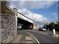
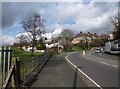
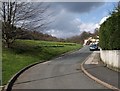
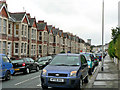
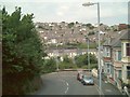
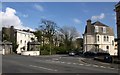
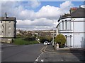
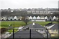
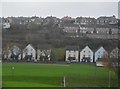
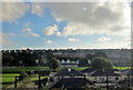
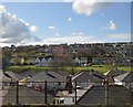
51 photos from this area
Area Information
Key information about the PL3 5AG including its size, population, and administrative classification.
- Area Type
- Postcode
- Area Size
- 2.9 hectares
- Population
- 1721
- Population Density
- 4575 people/km²
House Prices in PL3 5AG
30
Properties
£140,041
Average Sold Price
£44,000
Lowest Price
£234,000
Highest Price
Showing 30 properties
| Address | Type | Beds | Baths | Last Sale Price | Last Sale Date | |
|---|---|---|---|---|---|---|
| 14 Ashford Close, Plymouth, PL3 5AG | Terraced | 3 | 1 | £200,000 | Feb 2025 | |
| 2 Ashford Close, Plymouth, PL3 5AG | Terraced | 3 | 1 | £200,000 | Dec 2022 | |
| 6 Ashford Close, Plymouth, PL3 5AG | Retail | 3 | 1 | £234,000 | Sep 2022 | |
| 29 Ashford Close, Plymouth, PL3 5AG | Terraced | 3 | 1 | £176,000 | Jun 2021 | |
| 17 Ashford Close, Plymouth, PL3 5AG | Terraced | 3 | 1 | £175,000 | Apr 2019 | |
| 30 Ashford Close, Plymouth, PL3 5AG | Terraced | 3 | 1 | £170,000 | Nov 2018 | |
| 20 Ashford Close, Plymouth, PL3 5AG | Terraced | 3 | 1 | £160,000 | Jan 2018 | |
| 23 Ashford Close, Plymouth, PL3 5AG | Terraced | 3 | 1 | £155,000 | Apr 2017 | |
| 16 Ashford Close, Plymouth, PL3 5AG | Terraced | 3 | 1 | £169,000 | Nov 2016 | |
| 28 Ashford Close, Plymouth, PL3 5AG | Terraced | 3 | 1 | £145,000 | Jul 2015 |
Page 1 of 3
Energy Efficiency in PL3 5AG
Amenities
Schools
| Rank | School | Type | Entry gender | Ages |
|---|
Explore more schools in this area
Go to Schools tabDemographics
Household Size
Two person
most common
Accommodation Type
Houses
most common
Tenure
81
majority
Ethnic Group
White
most common
Religion
N/A
most common
Household Composition
N/A
most common
Age
47
median
Adults (30-64 years)
most common
Household Deprivation
N/A
with no deprivation
NS-SEC
38
in Lower managerial occupations
Explore more demographic insights in this area
Go to Demographics tabPlanning
Planning Constraints
- Flood RiskPremium
- Ramsar Wetland SitesPremium
- Area of Outstanding Natural BeautyPremium
- Protected Nature ReservePremium
- Protected WoodlandPremium