Area Overview for PL3 4SB
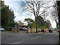
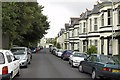
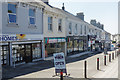
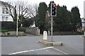
Photos of PL3 4SB


Area Information
Living in PL3 4SB offers a settled life within a compact residential cluster of just one hectare. The postcode covers a small area that supports a population of 1,480 people, creating a tight-knit environment where the community is close at hand. Residents navigate this dense setting with awareness of the surrounding infrastructure, which places them in a practical reach of major transport hubs. This specific location avoids planning constraints such as protected nature reserves or Areas of Outstanding Natural Beauty, simplifying the planning context for the area. You will find yourself in a neighbourhood defined by its residential focus, with a high population density reflecting the集中度 of homes in this space. Daily life here involves easy access to Plymouth Railway Station, Devonport Railway Station, and Dockyard Railway Station for commuters. Ferry links via Plymouth Landing Stage, Plymouth Mount Batten Ferry Landing, and Plymouth Ferry Terminal provide further mobility. The postcode sits in England, offering a specific slice of property life where the balance between proximity to services and residential comfort is established. This small footprint means that amenities are often just steps away rather than a significant drive.
- Area Type
- Postcode
- Area Size
- 1.0 hectares
- Population
- 1480
- Population Density
- 8213 people/km²
The property market in PL3 4SB is characterised by a strong leaning towards owner occupation. With 65% of homes owned outright, the area functions primarily as an established residential zone rather than a high-volume rental market. This high ownership percentage suggests that most residents have decided to stay long-term, creating a stable housing stock. The predominant accommodation type consists of houses, which defines the physical character of the streets and gardens within this one-hectare area. When looking at homes in PL3 4SB, you are likely to encounter a range of properties suited to families and empty nesters. The lower population density of 14,558 people per square kilometre is counterintuitively high for a small area, indicating a concentrated cluster of housing. This density means that even though the area is small, the built environment is significant for the local landscape. Buyers seeking houses in this postcode will find a market driven by retention rather than turnover. The mix of school-type academies nearby supports families seeking to keep their roots in the area.
House Prices in PL3 4SB
Showing 24 properties
| Address | Type | Beds | Baths | Last Sale Price | Last Sale Date | |
|---|---|---|---|---|---|---|
| 23 Mutley Road, Plymouth, PL3 4SB | Terraced | 3 | 1 | £305,000 | Apr 2024 | |
| 16 Mutley Road, Plymouth, PL3 4SB | Terraced | 4 | 1 | £382,000 | Mar 2024 | |
| 28 Mutley Road, Plymouth, PL3 4SB | house | 4 | 1 | £432,500 | May 2022 | |
| 30 Mutley Road, Plymouth, PL3 4SB | Terraced | 5 | 1 | £420,000 | Aug 2017 | |
| 37 Mutley Road, Plymouth, PL3 4SB | Terraced | 4 | 2 | £265,000 | Jun 2017 | |
| 20 Mutley Road, Plymouth, PL3 4SB | Terraced | 5 | 2 | £325,000 | Mar 2016 | |
| 27 Mutley Road, Plymouth, PL3 4SB | Terraced | 3 | - | £205,000 | Jan 2013 | |
| 35 Mutley Road, Plymouth, PL3 4SB | Flat | 1 | 1 | £199,000 | Oct 2011 | |
| 25 Mutley Road, Plymouth, PL3 4SB | Terraced | - | - | £199,000 | May 2010 | |
| 34 Mutley Road, Plymouth, PL3 4SB | Terraced | 5 | 2 | £272,500 | Sep 2008 |
Energy Efficiency in PL3 4SB
Residents of PL3 4SB enjoy convenient access to a range of amenities within practical reach. The local retail scene includes Tesco Mutley, Co-op Peverell, and Co-op Mutley, ensuring that daily shopping needs are met without a long journey. There are five retail venues nearby, providing a small but functional high street experience within the immediate vicinity. Transport connectivity is further enhanced by proximity to five rail stations, including Plymouth Railway Station and Devonport Railway Station. Public ferry accessibility is also strong, with five landing points such as Plymouth Landing Stage and Plymouth Ferry Terminal nearby. Two airports serve the region, including Plymouth City Airport, facilitating longer travel requirements for residents. These facilities create a lifestyle where work and leisure are easily accessible. The combination of local shops and major transport hubs means you can manage daily errands effortlessly while maintaining the ability to travel further when needed. This layout supports a balanced life where convenience does not compromise the residential nature of the postcode.
Amenities
Schools
Families living in PL3 4SB benefit from several educational institutions within their local vicinity. Hyde Park Junior School is a primary academy with a good Ofsted rating, providing a solid foundation for secondary education preparation. Hyde Park Infants' School operates as both a primary school and an academy, offering continuity for young children. Multiple entries in the local records confirm the presence of these two institutions, ensuring that residents have access to specific educational settings. The mix of primary and infant stages means you will find institutions catering to every early childhood requirement without needing to travel further afield. The Ofsted rating of good associated with Hyde Park Junior School provides a concrete metric for quality assurance. Since the data lists specific academy statuses, you can be certain that these schools operate under the current national framework. This cluster of schools serves the population of 1,480 residents directly, ensuring that the youngest members of the community have local access to learning environments.
| Rank | School | Type | Entry gender | Ages |
|---|
Explore more schools in this area
Go to Schools tabDemographics
The community in PL3 4SB reflects a mature and established residential profile. The median age is 47, indicating that adults between 30 and 64 years represent the most common age range in this neighbourhood. You will see a community where long-term residents form the core of the local demographic. Home ownership is high, with 65% of households owning their homes. This statistic highlights a stable environment where many families and individuals have put down roots in the region. The predominant ethnic group in the area is White, which shapes the cultural character of the neighbourhood. Most dwellings take the form of houses, aligning with the preferences of the owner-occupier majority. Data regarding deprivation is not provided in the available records, so specific commentary on that metric is not possible. Instead, the focus remains on the clear picture of age and ownership. A median age of 47 suggests families are likely to be established, and the high ownership rate reinforces this stability. The accommodation type is predominantly houses, which fits the profile of a suburban or semi-rural cluster within the broader Plymouth surroundings.
Household Size
Accommodation Type
Tenure
Ethnic Group
Religion
Household Composition
Age
Household Deprivation
NS-SEC
Explore more demographic insights in this area
Go to Demographics tabPlanning
Planning Constraints
- Flood RiskPremium
- Ramsar Wetland SitesPremium
- Area of Outstanding Natural BeautyPremium
- Protected Nature ReservePremium
- Protected WoodlandPremium