Area Overview for PL29 3RL
Photos of PL29 3RL
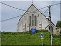
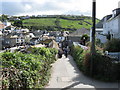
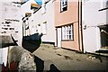
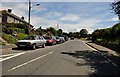
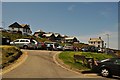
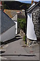
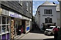

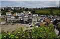
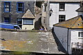
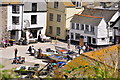
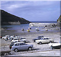
100 photos from this area
Area Information
Key information about the PL29 3RL including its size, population, and administrative classification.
- Area Type
- Postcode
- Area Size
- 9002 m²
- Population
- 1936
- Population Density
- 42 people/km²
House Prices in PL29 3RL
15
Properties
£384,063
Average Sold Price
£79,500
Lowest Price
£690,000
Highest Price
Showing 15 properties
| Address | Type | Beds | Baths | Last Sale Price | Last Sale Date | |
|---|---|---|---|---|---|---|
| 19 Rose Hill, Port Isaac, PL29 3RL | Retail | 3 | 1 | £495,000 | Jan 2023 | |
| 17 Rose Hill, Port Isaac, PL29 3RL | house | 2 | 2 | £690,000 | Nov 2022 | |
| 25 ROSE HILL, Port Isaac, PL29 3RL | Semi-detached | - | - | £571,000 | Sep 2021 | |
| Hideaway Cottage, 21 Rose Hill, Port Isaac, PL29 3RL | house | 3 | - | £540,000 | Aug 2020 | |
| 23 Rose Hill, Port Isaac, PL29 3RL | house | - | - | £410,000 | Jul 2009 | |
| 1 Rose Hill, Port Isaac, PL29 3RL | Cottage | 1 | 1 | £187,000 | Jul 2006 | |
| 15 Rose Hill, Port Isaac, PL29 3RL | Terraced | - | - | £100,000 | Feb 1997 | |
| 27 Rose Hill, Port Isaac, PL29 3RL | Semi-detached | - | - | £79,500 | Mar 1996 | |
| 4 Rose Hill, Port Isaac, PL29 3RL | Cottage | 1 | 1 | - | - | |
| 3 Rose Hill, Port Isaac, PL29 3RL | Cottage | 1 | 1 | - | - |
Page 1 of 2
Energy Efficiency in PL29 3RL
Amenities
Schools
| Rank | School | Type | Entry gender | Ages |
|---|
Explore more schools in this area
Go to Schools tabDemographics
Household Size
Two person
most common
Accommodation Type
Houses
most common
Tenure
69
majority
Ethnic Group
White
most common
Religion
N/A
most common
Household Composition
N/A
most common
Age
47
median
Adults (30-64 years)
most common
Household Deprivation
N/A
with no deprivation
NS-SEC
28
in Lower managerial occupations
Explore more demographic insights in this area
Go to Demographics tabPlanning
Planning Constraints
- Flood RiskPremium
- Ramsar Wetland SitesPremium
- Area of Outstanding Natural BeautyPremium
- Protected Nature ReservePremium
- Protected WoodlandPremium