Area Overview for PL28 8LE
Photos of PL28 8LE
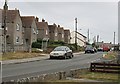
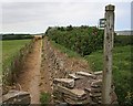
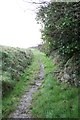
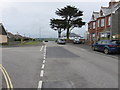
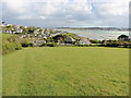
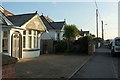
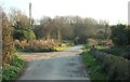
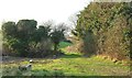
21 photos from this area
Area Information
Key information about the PL28 8LE including its size, population, and administrative classification.
- Area Type
- Postcode
- Area Size
- 1.2 km²
- Population
- 1512
- Population Density
- 122 people/km²
House Prices in PL28 8LE
18
Properties
£422,500
Average Sold Price
£350,000
Lowest Price
£495,000
Highest Price
Showing 18 properties
| Address | Type | Beds | Baths | Last Sale Price | Last Sale Date | |
|---|---|---|---|---|---|---|
| Curchey Cottage, A 389 Between Greenlane And Padstow Road, Padstow, PL28 8LE | house | - | - | £495,000 | Jun 2021 | |
| Trerethern Barn, Access To Trerethern, Padstow, PL28 8LE | Detached | 5 | 3 | £350,000 | Feb 2020 | |
| Trerethern Farm, Access To Trerethern, Padstow, PL28 8LE | Detached | 5 | 3 | - | - | |
| Tremorvah Farmhouse, A 389 Between Greenlane And Padstow Road, Padstow, PL28 8LE | Lodge | 4 | 1 | - | - | |
| Caravan, Padstow Touring Park, Access To Trerethern, Padstow, PL28 8LE | Mobile Home | 2 | 2 | - | - | |
| The Old Barn, Trerethern Farm, Access To Trerethern, Padstow, PL28 8LE | Detached | 3 | 3 | - | - | |
| The Bungalow, Padstow Touring Park, Access To Trerethern, Padstow, PL28 8LE | Bungalow | 2 | 2 | - | - | |
| THE CARAVAN, TREVETHAN FARMHOUSE, ACCESS TO TREVETHAN FARMHOUSE, Sarahs Lane, Padstow, PL28 8LE | Mobile Home | - | - | - | - | |
| Poltair Development Site Office, Polpennic Drive, Padstow, PL28 8LE | Office | - | - | - | - | |
| Stable Cottage, Trevethan Farmhouse, Access To Trevethan Farmhouse, Sarahs Lane, Padstow, PL28 8LE | Semi-detached | - | - | - | - |
Page 1 of 2
Energy Efficiency in PL28 8LE
Amenities
Schools
| Rank | School | Type | Entry gender | Ages |
|---|
Explore more schools in this area
Go to Schools tabDemographics
Household Size
Two person
most common
Accommodation Type
Houses
most common
Tenure
68
majority
Ethnic Group
White
most common
Religion
N/A
most common
Household Composition
N/A
most common
Age
47
median
Adults (30-64 years)
most common
Household Deprivation
N/A
with no deprivation
NS-SEC
25
in Lower managerial occupations
Explore more demographic insights in this area
Go to Demographics tabPlanning
Planning Constraints
- Flood RiskPremium
- Ramsar Wetland SitesPremium
- Area of Outstanding Natural BeautyPremium
- Protected Nature ReservePremium
- Protected WoodlandPremium