Area Overview for PL28 8DA
Photos of PL28 8DA
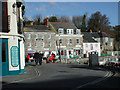
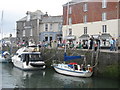
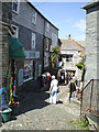
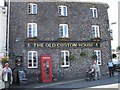
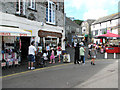
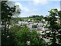
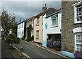
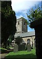
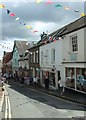
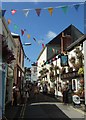
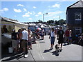
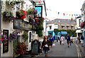
100 photos from this area
Area Information
Key information about the PL28 8DA including its size, population, and administrative classification.
- Area Type
- Postcode
- Area Size
- 4976 m²
- Population
- 1005
- Population Density
- 886 people/km²
House Prices in PL28 8DA
12
Properties
£1,222,500
Average Sold Price
£745,000
Lowest Price
£1,700,000
Highest Price
Showing 12 properties
| Address | Type | Beds | Baths | Last Sale Price | Last Sale Date | |
|---|---|---|---|---|---|---|
| Rock View, Station Road, Padstow, PL28 8DA | Land | 9 | 6 | £1,700,000 | Jul 2022 | |
| Blair House, Station Road, Padstow, PL28 8DA | house | - | - | £745,000 | Feb 2016 | |
| The Bungalow, Station Road, Padstow, PL28 8DA | Flat | 2 | 2 | - | - | |
| Owners Accommodation, Treverbyn Guest House, Station Road, Padstow, PL28 8DA | Detached | 9 | 6 | - | - | |
| The Vicarage, Station Road, Padstow, PL28 8DA | Detached | - | - | - | - | |
| Old Station House, Station Road, Padstow, PL28 8DA | Office | - | - | - | - | |
| Steins, Unit 3, Padstow Quays, Station Road, Padstow, PL28 8DA | shop | - | - | - | - | |
| Steins Deli, Unit 5, Padstow Quays, Station Road, Padstow, PL28 8DA | warehouse | - | - | - | - | |
| Tootie Fruite, Station Road, Padstow, PL28 8DA | Restaurant | - | - | - | - | |
| Kiosk Adj, Old Station House, Station Road, Padstow, PL28 8DA | Restaurant | - | - | - | - |
Page 1 of 2
Energy Efficiency in PL28 8DA
Amenities
Schools
| Rank | School | Type | Entry gender | Ages |
|---|
Explore more schools in this area
Go to Schools tabDemographics
Household Size
One person
most common
Accommodation Type
Houses
most common
Tenure
51
majority
Ethnic Group
White
most common
Religion
N/A
most common
Household Composition
N/A
most common
Age
47
median
Adults (30-64 years)
most common
Household Deprivation
N/A
with no deprivation
NS-SEC
25
in Lower managerial occupations
Explore more demographic insights in this area
Go to Demographics tabPlanning
Planning Constraints
- Flood RiskPremium
- Ramsar Wetland SitesPremium
- Area of Outstanding Natural BeautyPremium
- Protected Nature ReservePremium
- Protected WoodlandPremium