Area Overview for PL27 7TG
Photos of PL27 7TG
Area Information
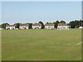
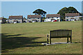
PL27 7TG represents a specific residential cluster in the south west of England. This postcode covers a small area measuring 1.2 hectares and supports a population of 1,603 people. The density averages 65 people per square kilometre, creating a setting that feels intimate rather than urban. Living in PL27 7TG means residing in a defined zone where the built environment accommodates a settled community. The location focuses on residential use, removing the noise and congestion often found in larger town centres. You will find a neighbourhood character defined by its modest size and clear boundaries. Daily life here revolves around the immediate surroundings without the pressure of dealing with heavy through-traffic or sprawling infrastructure. This cluster provides a stable home base for residents who value a contained lifestyle. The area functions as a quiet pocket within Cornwall's broader landscape, offering convenience without the scale of a major town.
- Area Type
- Postcode
- Area Size
- 1.2 hectares
- Population
- 1603
- Population Density
- 65 people/km²
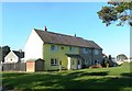
Homes in PL27 7TG are defined by a clear dominance of the owner-occupier market. With 64 per cent of residents owning their property, this postcode functions primarily as an area for buying rather than for short-term renting. The accommodation type is exclusively houses, meaning you will not find flats or apartments within this specific 1.2 hectare cluster. This single-family housing stock appeals to those seeking privacy and independence. The high ownership rate suggests that these properties have stood the test of time and represent significant financial commitments for their current holders. Buyers looking at this area will encounter a market where price often reflects the security of long-term habitation. The lack of rental stock means that supply is dictated by the decisions of existing owners who may wish to sell or stay put. If you are considering a move, you are entering a neighbourhood where stability and permanent settlement are the norm rather than the exception.
House Prices in PL27 7TG
Showing 27 properties
| Address | Type | Beds | Baths | Last Sale Price | Last Sale Date | |
|---|---|---|---|---|---|---|
| 10 Halifax Road, St Eval, Wadebridge, PL27 7TG | Semi-detached | 3 | 1 | £240,000 | Jan 2025 | |
| 24 Halifax Road, St Eval, Wadebridge, PL27 7TG | Semi-detached | 3 | 2 | £310,000 | Oct 2024 | |
| 5 Halifax Road, St Eval, Wadebridge, PL27 7TG | house | - | - | £220,000 | May 2021 | |
| 18 Halifax Road, St Eval, Wadebridge, PL27 7TG | house | - | - | £215,000 | Mar 2021 | |
| 20 Halifax Road, St Eval, Wadebridge, PL27 7TG | Semi-detached | 3 | 2 | £250,000 | Aug 2019 | |
| 23 Halifax Road, St Eval, Wadebridge, PL27 7TG | house | 3 | - | £199,500 | May 2018 | |
| 11 Halifax Road, St Eval, Wadebridge, PL27 7TG | house | - | - | £200,000 | Apr 2018 | |
| 1 Halifax Road, St Eval, Wadebridge, PL27 7TG | Semi-detached | 3 | 1 | £172,000 | Nov 2017 | |
| 16 Halifax Road, St Eval, Wadebridge, PL27 7TG | Semi-detached | 3 | - | £173,000 | Jun 2017 | |
| 15 Halifax Road, St Eval, Wadebridge, PL27 7TG | Semi-detached | 3 | - | £165,000 | Aug 2016 |
Energy Efficiency in PL27 7TG
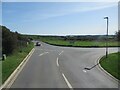
Residents of PL27 7TG enjoy direct access to several key amenities within practical reach. You have two airports close by; Newquay St Mawgan Airport and Newquay Cornwall Airport allow for easy travel or charter flights. For daily shopping, five retail outlets are nearby, including Spar, Co-op St, and Tesco Padstow. These locations cover your essential food and household needs. Transport links are supported by three railway stations: Quintrell Downs Railway Station, St Columb Road Railway Station, and Newquay Railway Station. Two ferry landings, Padstow Ferry Landing and Rock Padstow Ferry Landing, provide access to the moorings or crossing needs for local water users. This variety of transport and retail options means you do not need to travel far for most errands. The presence of major chains like Tesco and Co-op alongside smaller operators ensures variety. Your lifestyle balances convenience with the smaller scale of your home location.
Amenities
Schools
Families living in PL27 7TG have access to two specific primary education options nearby. Trevisker Community Primary School serves the local community as a primary institution. Trevisker Primary School also operates in the vicinity, offering an alternative primary education choice for residents. Both schools focus on the early years of a child's academic development. The presence of two primary schools indicates that the immediate locality caters to young children. There are no secondary schools listed within the provided data for this postcode, meaning older children will likely travel to other towns for secondary education. This separation of primary and secondary education is common in smaller Cornish clusters. Parents selecting homes here should verify the specific catchment areas for their children's ages. The naming similarity between the two primary schools suggests they may be part of the same community educational network or serve overlapping neighbourhoods.
| Rank | School | Type | Entry gender | Ages |
|---|
Explore more schools in this area
Go to Schools tabDemographics
The community within PL27 7TG reflects a mature demographic profile. The median age stands at 47 years, indicating a population largely composed of adults between 30 and 64 years of age. You will find that the area is dominated by families needing space or retirees seeking a calm retirement setting. Home ownership is high at 64 per cent, suggesting that most people living here have purchased their properties and have settled down. The accommodation type consists primarily of houses, which aligns with the need for family homes or spacious living quarters. The predominant ethnic group is White, which matches the national average and creates a demographically typical English village feel. This ownership rate contrasts with many urban areas where renting remains common. A quarter of the residents do not own their homes, whether they rent or own with a mortgage. The age structure and ownership levels indicate a stable community where long-term residents form the backbone of the local social fabric.
Household Size
Accommodation Type
Tenure
Ethnic Group
Religion
Household Composition
Age
Household Deprivation
NS-SEC
Explore more demographic insights in this area
Go to Demographics tabPlanning
Planning Constraints
- Flood RiskPremium
- Ramsar Wetland SitesPremium
- Area of Outstanding Natural BeautyPremium
- Protected Nature ReservePremium
- Protected WoodlandPremium