Area Overview for PL27 7TF
Photos of PL27 7TF
Area Information
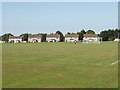
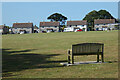
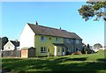
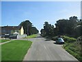
Living in PL27 7TF places you at the heart of a compact residential cluster covering 7,899 square metres. This postcode serves a specific population of 1,603 residents, creating an environment where neighbours are close but privately owned space remains largely intact. The area sits within the broader locale of Padstow, offering a distinct balance between rural accessibility and local convenience. Daily life here revolves around a mix of commuter access and proximity to coastal towns. You will find yourself in a setting defined by generous outdoor space relative to its small footprint, with low population density ensuring a quiet atmosphere. The character of PL27 7TF is one of established domestic stability, where the immediate surroundings are familiar and well-known. Residents benefit from being situated away from heavy urban noise yet maintain practical links to larger service hubs. This area provides a grounded foundation for those seeking a home that offers privacy without complete isolation from local employment or leisure networks. The compact nature of the postcode means that everything from weekly shopping to school runs can be managed efficiently from your doorstep.
- Area Type
- Postcode
- Area Size
- 7899 m²
- Population
- 1603
- Population Density
- 65 people/km²
The property market in PL27 7TF is defined by substantial owner-occupancy, where 64 per cent of homes are owned outright or with a mortgage. Houses form the core of the housing stock, meaning you will encounter detached or semi-detached accommodation rather than flats or converted buildings. This demolition of rental dominance suggests a stable market where sale prices reflect long-term value rather than fluctuating renter demand. Buyers looking at this small area and its immediate surroundings should expect to compete with motivated owners who intend to stay put. The high proportion of house ownership indicates that the local estate is not a hotbed of short-term speculation or house-flipping activity. Instead, properties reflect the tastes and financial means of families who have put down roots. Because houses predominately make up the stock, the architecture and layout of the homes will suit those seeking private gardens and separate living spaces. The market here rewards patience and readiness to engage with local sellers who understand the specific character of the PL27 7TF neighbourhood. This owner-led dynamic generally results in a more predictable and steady environment for your property investment.
House Prices in PL27 7TF
Showing 7 properties
| Address | Type | Beds | Baths | Last Sale Price | Last Sale Date | |
|---|---|---|---|---|---|---|
| 7 Spitfire Row, St Eval, Wadebridge, PL27 7TF | Detached | 4 | - | £338,000 | Feb 2017 | |
| 2 Spitfire Row, St Eval, Wadebridge, PL27 7TF | house | 4 | - | £260,000 | Jul 2012 | |
| 4 Spitfire Row, St Eval, Wadebridge, PL27 7TF | Bungalow | - | - | £197,500 | May 2012 | |
| 3 Spitfire Row, St Eval, Wadebridge, PL27 7TF | house | 4 | - | £243,000 | Apr 2012 | |
| 1 Spitfire Row, St Eval, Wadebridge, PL27 7TF | Detached | 4 | 2 | £248,250 | Apr 2012 | |
| 5 Spitfire Row, St Eval, Wadebridge, PL27 7TF | Bungalow | 4 | 2 | £195,000 | Jan 2012 | |
| 6 Spitfire Row, St Eval, Wadebridge, PL27 7TF | Bungalow | - | - | £220,000 | Apr 2011 |
Energy Efficiency in PL27 7TF
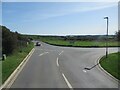
Daily life in PL27 7TF is supported by a diverse array of amenities within practical reach of your home. Two airports, including Newquay St Mawgan Airport and Newquay Cornwall Airport, sit nearby, offering convenient air travel connections for holidays and business trips. Local shopping needs are met by five retail outlets, featuring specific stores such as Spar, Co-op St, and Tesco Padstow. You can complete your weekly groceries and household essentials from these well-known supermarket chains without needing to commute far. Two ferry landing sites, Padstow Ferry Landing and Rock Padstow Ferry Landing, provide direct sea travel options for maritime adventures or island visits. Transport links include three railway stations: Quintrell Downs Railway Station, St Columb Road Railway Station, and Newquay Railway Station, giving you multiple choices for train travel into Cornwall and beyond. This network of airports, feries, and railheads means you can reach major destinations quickly while enjoying the convenience of local shops. The presence of these specific venues ensures that lifestyle needs from travel to shopping are all addressed without leaving the immediate region.
Amenities
Schools
Families moving to PL27 7TF have access to two primary institutions within reasonable distance. Trevisker Community Primary School serves the local community as a main educational provision, while Trevisker Primary School operates as a secondary option adjacent to it. Both schools function as primary education providers, ensuring that younger children receive their foundational learning in recognised establishments. The presence of two named schools suggests a cluster of educational facilities that can cater to different matriculation needs within the immediate vicinity. For parents, this means you do not need to travel far to secure a school place for your children. Both institutions share the Trevisker name, which often denotes a shared heritage or governing body within the local education network. This concentration of primary schools creates a supportive environment for children transitioning from nursery to formal education. You can expect a focused local network where schools interact with parents' groups and community organisations regularly. These specific named institutions form the backbone of educational access for households residing in this postcode.
| Rank | School | Type | Entry gender | Ages |
|---|
Explore more schools in this area
Go to Schools tabDemographics
The community in PL27 7TF is established and mature, characterised by a median age of 47 years. Adults between 30 and 64 years represent the most common age range, indicating a household base focused on family life and career stability rather than a transient youth population. Home ownership stands at a solid 64 per cent, suggesting that the majority of residents have purchased their properties and are entrenched in the local scene. Houses make up the predominant accommodation type, reinforcing the residential nature of the postcode and the absence of high-rise or shared-sector blocks. The area reflects a predominantly White ethnic demographic, contributing to a culturally defined community with deep local roots. This demographic profile paints a picture of a settled neighbourhood where families have likely lived for many years, fostering strong local ties. The higher home ownership rate often correlates with greater investment in properties and longer-term stability within the estate. You are joining a community that values ownership and continuity over short-term letting or rapid turnover. These figures signal a quiet, family-oriented environment where social interactions are likely recurring and familiar.
Household Size
Accommodation Type
Tenure
Ethnic Group
Religion
Household Composition
Age
Household Deprivation
NS-SEC
Explore more demographic insights in this area
Go to Demographics tabPlanning
Planning Constraints
- Flood RiskPremium
- Ramsar Wetland SitesPremium
- Area of Outstanding Natural BeautyPremium
- Protected Nature ReservePremium
- Protected WoodlandPremium