Area Overview for PL27 7LQ
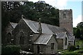
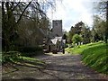
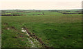
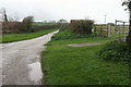
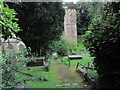
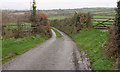
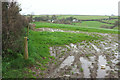
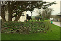
Photos of PL27 7LQ
Area Information
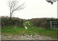
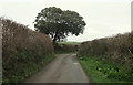
PL27 7LQ is a specific postcode area covering a small residential cluster of 24.8 hectares. You will find 1,297 people living within this compact boundary, creating a close-knit environment where neighbours know one another. The population density stands at 25 people per square kilometre, which offers a quiet pace of life distinct from the noise of larger towns. This area functions as a practical choice for those seeking shelter in Cornwall's rural fringe without the isolation of a remote hamlet. Daily life here balances seclusion with access to wider networks, allowing residents to enjoy a slower rhythm while maintaining reasonable connections to services. The mix of households suggests a community focused on stability rather than rapid turnover. With over two-thirds of residents owning their homes, the area feels settled and established. You move here expecting a partnership between nature and habitation, rather than a dense urban sprawl. The built environment supports a lifestyle centred on independence and local ties. When you look at the surroundings, you are entering a space defined by its modest scale and deliberate residential focus. This reality forms the foundation of your potential living experience in this distinctive stretch of countryside.
- Area Type
- Postcode
- Area Size
- 24.8 hectares
- Population
- 1297
- Population Density
- 25 people/km²
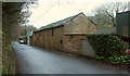
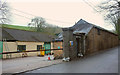
You are looking at a property market defined by ownership rather than rentals. With 68% of residents owning their homes, PL27 7LQ functions as a stable owner-occupied neighbourhood. This statistic implies that sellers here have traditionally prioritised staying in their homes for extended periods. The local stock consists almost entirely of houses, which dictates your search strategy if you wish to live in this area. You will not find high-rise apartments or purpose-built multi-occupancy blocks within the main residential cluster. The dominance of single-family homes creates a buying environment where character and physical condition matter significantly. Prospective buyers encounter a market where properties reflect the preferences of owners who have remained for decades. This lack of rental influence often means better maintenance and fewer short-term disruptions. When you examine the housing stock in PL27 7LQ, you are evaluating assets held by people who view their homes as long-term investments. This stability offers a different dynamic compared to urban markets dominated by landlord-tenant relationships.
House Prices in PL27 7LQ
Showing 2 properties
| Address | Type | Beds | Baths | Last Sale Price | Last Sale Date | |
|---|---|---|---|---|---|---|
| The Crag, Road From Polmorla Road To Tredruston Road, St Breock, Wadebridge, PL27 7LQ | Detached | 6 | 6 | £925,000 | Jan 2019 | |
| Polmorla Market Gardens, Road From Polmorla Road To Tredruston Road, St Breock, Wadebridge, PL27 7LQ | Detached | - | - | - | - |
Energy Efficiency in PL27 7LQ
Your daily routine in PL27 7LQ benefits from accessible amenities within practical reach. Retail options include Tesco Wadebridge, Aldi Wadebridge, and M&S Wadebridge BP, providing essential shopping without needing to travel far. You can access daily necessities like groceries and clothing with ease. These supermarkets serve as key anchors for your local lifestyle, offering convenience that reduces the need for unnecessary journeys. Transport links further enhance your quality of life. You will find ferry connections nearby at Rock Padstow Ferry Landing and Padstow Ferry Landing, allowing you to reach other parts of Cornwall quickly. Rail access is available via Roche Railway Station, giving you another option for commuting when weather conditions permit. The crest line of Boscarne Junction also appears in your transport options, facilitating road movement. This mix of services ensures you maintain flexibility in your daily movements. You live in an area where essential services and leisure travel remain within arm's reach, balancing rural tranquillity with urban convenience.
Amenities
Schools
| Rank | School | Type | Entry gender | Ages |
|---|
Explore more schools in this area
Go to Schools tabDemographics
The community in PL27 7LQ is dominated by adults aged between 30 and 64 years. This age range represents the most common demographic group, indicating a population built around maturity and family life. The median age sits at 47 years, reinforcing the image of an area settled by established households rather than young singles or transient students. You will encounter a community where long-term planning replaces the uncertainty of early adulthood. Home ownership in PL27 7LQ reaches 68%, confirming that the majority of residents hold title to their properties. This high ownership rate signals a neighbourhood where people have invested in their future and built equity over time. Houses remain the primary form of accommodation, meaning you will see traditional structures rather than typical apartment blocks. The predominant ethnic group is White, which aligns with the broader demographic makeup of rural Cornwall. This profile paints a picture of a diverse but predominantly traditional community where values of stability and permanence drive social interactions.
Household Size
Accommodation Type
Tenure
Ethnic Group
Religion
Household Composition
Age
Household Deprivation
NS-SEC
Explore more demographic insights in this area
Go to Demographics tabPlanning
Planning Constraints
- Flood RiskPremium
- Ramsar Wetland SitesPremium
- Area of Outstanding Natural BeautyPremium
- Protected Nature ReservePremium
- Protected WoodlandPremium