Area Overview for PL27 6TB
Photos of PL27 6TB
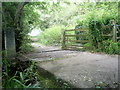
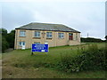
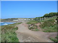
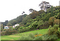
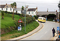
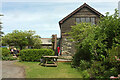
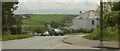
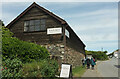
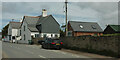
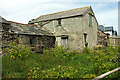
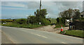
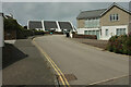
56 photos from this area
Area Information
Key information about the PL27 6TB including its size, population, and administrative classification.
- Area Type
- Postcode
- Area Size
- 5.0 hectares
- Population
- 2041
- Population Density
- 66 people/km²
House Prices in PL27 6TB
9
Properties
£458,841
Average Sold Price
£110,000
Lowest Price
£807,681
Highest Price
Showing 9 properties
| Address | Type | Beds | Baths | Last Sale Price | Last Sale Date | |
|---|---|---|---|---|---|---|
| Skippers Cottage, Dunders Hill, Polzeath, Wadebridge, PL27 6TB | house | - | - | £807,681 | Jul 2021 | |
| Smugglers Cottage, Dunders Hill, Polzeath, Wadebridge, PL27 6TB | Terraced | - | - | £110,000 | Jan 1999 | |
| Anns Cottage, Dunders Hill, Polzeath, Wadebridge, PL27 6TB | Semi-detached | - | - | - | - | |
| Public Conveniences, Dunders Hill, Polzeath, Wadebridge, PL27 6TB | commercial | - | - | - | - | |
| The Flat, The Beach House, Dunders Hill, Polzeath, Wadebridge, PL27 6TB | Flat | - | - | - | - | |
| Cornish Beach Foods, Polzeath Beach, Dunders Hill, Polzeath, Wadebridge, PL27 6TB | Restaurant | - | - | - | - | |
| Surfside Beach Shop, Access To Polzeath Beach Caravan Park, Polzeath, Wadebridge, PL27 6TB | Retail | - | - | - | - | |
| Surf Side, Access To Polzeath Beach Caravan Park, Polzeath, Wadebridge, PL27 6TB | Flat | - | - | - | - | |
| Polzeath House, Dunders Hill, Polzeath, Wadebridge, PL27 6TB | Detached | - | - | - | - |
Energy Efficiency in PL27 6TB
Amenities
Schools
| Rank | School | Type | Entry gender | Ages |
|---|
Explore more schools in this area
Go to Schools tabDemographics
Household Size
Two person
most common
Accommodation Type
Houses
most common
Tenure
65
majority
Ethnic Group
White
most common
Religion
N/A
most common
Household Composition
N/A
most common
Age
47
median
Adults (30-64 years)
most common
Household Deprivation
N/A
with no deprivation
NS-SEC
35
in Lower managerial occupations
Explore more demographic insights in this area
Go to Demographics tabPlanning
Planning Constraints
- Flood RiskPremium
- Ramsar Wetland SitesPremium
- Area of Outstanding Natural BeautyPremium
- Protected Nature ReservePremium
- Protected WoodlandPremium