Area Overview for PL27 6JX
Photos of PL27 6JX
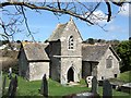


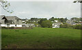
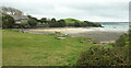


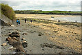
48 photos from this area
Area Information
Key information about the PL27 6JX including its size, population, and administrative classification.
- Area Type
- Postcode
- Area Size
- 53.0 hectares
- Population
- 2041
- Population Density
- 66 people/km²
House Prices in PL27 6JX
33
Properties
£1,271,000
Average Sold Price
£585,000
Lowest Price
£2,100,000
Highest Price
Showing 33 properties
| Address | Type | Beds | Baths | Last Sale Price | Last Sale Date | |
|---|---|---|---|---|---|---|
| Sandy Corner, Porthilly Lane, Rock, Wadebridge, PL27 6JX | Detached | 4 | 3 | £2,100,000 | Feb 2023 | |
| Porthilly Bridge, Porthilly Lane, Rock, Wadebridge, PL27 6JX | Detached | 5 | - | £1,470,000 | Jul 2013 | |
| Three Farthings, Porthilly Lane, Rock, Wadebridge, PL27 6JX | house | - | - | £585,000 | Mar 2012 | |
| Little Porthilly, Porthilly Lane, Rock, Wadebridge, PL27 6JX | house | - | - | £1,300,000 | May 2010 | |
| Ships Lantern, Porthilly Lane, Rock, Wadebridge, PL27 6JX | house | 3 | - | £900,000 | Apr 2010 | |
| Trewennow, Porthilly Lane, Rock, Wadebridge, PL27 6JX | Detached | 4 | 2 | - | - | |
| 1, Porthilly Cottages, Porthilly Lane, Rock, Wadebridge, PL27 6JX | Cottage | 4 | 3 | - | - | |
| Foys, Porthilly Lane, Rock, Wadebridge, PL27 6JX | Detached | 5 | 4 | - | - | |
| 2, Porthilly Cottages, Porthilly Lane, Rock, Wadebridge, PL27 6JX | Terraced | 2 | 1 | - | - | |
| The Caravan At Little Porthilly, Porthilly Lane, Rock, Wadebridge, PL27 6JX | Mobile Home | - | - | - | - |
Page 1 of 4
Energy Efficiency in PL27 6JX
Amenities
Schools
| Rank | School | Type | Entry gender | Ages |
|---|
Explore more schools in this area
Go to Schools tabDemographics
Household Size
Two person
most common
Accommodation Type
Houses
most common
Tenure
65
majority
Ethnic Group
White
most common
Religion
N/A
most common
Household Composition
N/A
most common
Age
47
median
Adults (30-64 years)
most common
Household Deprivation
N/A
with no deprivation
NS-SEC
35
in Lower managerial occupations
Explore more demographic insights in this area
Go to Demographics tabPlanning
Planning Constraints
- Flood RiskPremium
- Ramsar Wetland SitesPremium
- Area of Outstanding Natural BeautyPremium
- Protected Nature ReservePremium
- Protected WoodlandPremium