Area Overview for PL26 8NB
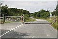
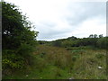
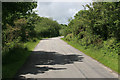
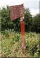
Photos of PL26 8NB
Area Information
Living in PL26 8NB means residing within a defined residential cluster covering 83.5 hectares. This postcode serves a community of 2,002 residents, resulting in a population density of just 65 people per square kilometre. You will find that this low-density environment offers a quiet setting compared to more urban locations. The layout supports houses as the primary accommodation type, creating a streetscape focused on detached or semi-detached dwellings rather than high-rise blocks. Daily life here is characterised by a manageable pace, where the proximity to train stations provides a vital link to wider transport networks without the immediate noise of a city centre. You can expect a neighbourhood where space is a defining feature, allowing for gardens and private outdoor areas. The area functions as a self-contained village feel, where local amenities are within a practical walking distance for many. Residents balance the tranquility of a small community with the convenience of rail access to Bugle and St Columb Road. This balance makes PL26 8NB a pragmatic choice for someone seeking a home away from the rush, yet still connected to the region's broader opportunities through existing rail links.
- Area Type
- Postcode
- Area Size
- 83.5 hectares
- Population
- 2002
- Population Density
- 65 people/km²
The property market in PL26 8NB is defined by a stock of houses, reflecting the preferences of the local population. A clear majority of residents, at 64 per cent, own their property outright or with a mortgage. This indicates that the area is primarily owner-occupied rather than a hub for private rentals. The prevalence of houses suggests that if you are looking at PL26 8NB, you will encounter detached or semi-detached properties suited to families or those seeking private outdoor space. This housing mix stands in contrast to high-density flats or terraced rows found in larger urban centres. The low population density of 65 people per square kilometre further underscores the spacious nature of the available homes. Buyers here typically value the lack of immediate隣ing neighbours over the convenience of city living. The market caters to those who prioritise a residential aesthetic and garden space over urban amenities. With few vacant rental units implied by the high ownership rate, competition for these houses may be moderate but directed towards a specific demographic seeking stability. The area offers a tangible alternative to commuter housing estates, focusing on individual family plots rather than shared development spaces.
House Prices in PL26 8NB
Showing 6 properties
| Address | Type | Beds | Baths | Last Sale Price | Last Sale Date | |
|---|---|---|---|---|---|---|
| Retillick Farm, Lane From Cleers Hill To Retillick Farm, Roche, PL26 8NB | house | - | - | £107,000 | Feb 2016 | |
| Retillick Cottage, Road From Gothers Hill To Cleers Hill, Roche, PL26 8NB | house | - | - | £270,000 | Sep 2015 | |
| Retillick Waters, Cleers Hill, Cleers, Roche, PL26 8NB | Detached | 2 | 1 | £135,000 | Feb 2013 | |
| Retillick Moor, Enniscaven Road, Roche, PL26 8NB | house | - | - | £145,000 | May 2000 | |
| The Annexe, Retillick Cottage, Road From Gothers Hill To Cleers Hill, Roche, PL26 8NB | Flat | - | - | - | - | |
| Retillick Moor Tip, Road From Gothers Hill To Cleers Hill, Roche, PL26 8NB | commercial | - | - | - | - |
Energy Efficiency in PL26 8NB
Your daily routine in PL26 8NB is supported by a practical selection of local amenities. Retail needs are met by five convenient stores, including Co-op Roche, Spar, and Co-op INDF. These shops offer essential grocery items and daily necessities within a short walk or drive. Transport links are equally accessible, with five stations located nearby: Roche Railway Station, Bugle Railway Station, and St Columb Road Railway Station. These stations provide regular rail services, allowing you to commute to larger towns or cities without relying on a car. The combination of retail outlets and rail infrastructure creates a self-sufficient lifestyle. You do not need to travel far for basic food shopping or scheduled transport. The area supports a low-carbon lifestyle where the nearest venues are within practical reach. There are no major leisure complexes or large shopping centres listed, meaning your lifestyle relies on these core facilities supplemented by local walking routes. The presence of Co-op stores specifically indicates a modern, accessible retail environment. You can expect a quiet but functional borough where you access what you need without the congestion of a high street.
Amenities
Schools
Families in PL26 8NB have access to three specific primary education options within the immediate vicinity. Roche Community Primary School serves as a local choice for younger children, providing dedicated early education. St Wenn School also operates as a primary institution, holding a good Ofsted rating. This rating offers concrete reassurance regarding educational standards and school performance. Having two primary options with explicitly named names allows parents to choose based on location proximity or specific reputation. The presence of primary schools confirms that this small residential cluster caters to families with young children. There are no secondary schools listed in the provided data, meaning families likely travel outside PL26 8NB for older education stages. The concentration of primary education suggests a community focused on raising children from an early age. Both Roche Community Primary School and St Wenn School are integral to the daily life of residents in this postcode. You will find that school catchment areas likely play a significant role in determining which homes in PL26 8NB attract the most interest. The availability of a rated institution like St Wenn School adds a layer of security for parents considering this area for their family's education.
| Rank | School | Type | Entry gender | Ages |
|---|
Explore more schools in this area
Go to Schools tabDemographics
The community in PL26 8NB reflects a mature population, with a median age of 47 years. Most residents fall within the adult age range of 30 to 64 years, suggesting a neighbourhood established by families and long-term occupants rather than transient students or young professionals. Homeownership is the dominant housing tenure, standing at 64 per cent of all households. This high rate of ownership indicates stability and long-term investment in the local estate. The predominant ethnic group is White, marking a largely traditional community structure. With 65 people living per square kilometre, the area feels spacious and uncluttered. The demographic profile suggests a settled population that values local schools and community spaces. The high homeownership percentage often correlates with residents who have lived in the area for significant periods. This stability can translate into a quieter street life compared to areas with high rental turnover. You are looking at a community where the majority of residents have built roots in their homes, likely prioritising low-density living over rapid urban change.
Household Size
Accommodation Type
Tenure
Ethnic Group
Religion
Household Composition
Age
Household Deprivation
NS-SEC
Explore more demographic insights in this area
Go to Demographics tabPlanning
Planning Constraints
- Flood RiskPremium
- Ramsar Wetland SitesPremium
- Area of Outstanding Natural BeautyPremium
- Protected Nature ReservePremium
- Protected WoodlandPremium