Area Overview for PL26 8DT
Photos of PL26 8DT
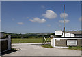

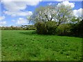
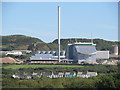
4 photos from this area
Area Information
Key information about the PL26 8DT including its size, population, and administrative classification.
- Area Type
- Postcode
- Area Size
- 9.4 hectares
- Population
- 1957
- Population Density
- 111 people/km²
House Prices in PL26 8DT
26
Properties
£128,224
Average Sold Price
£59,950
Lowest Price
£215,000
Highest Price
Showing 26 properties
| Address | Type | Beds | Baths | Last Sale Price | Last Sale Date | |
|---|---|---|---|---|---|---|
| 7 Whitegate Meadows, St Dennis, PL26 8DT | Semi-detached | 3 | 1 | £215,000 | Dec 2021 | |
| 6 Whitegate Meadows, St Dennis, PL26 8DT | Bungalow | - | - | £171,000 | May 2021 | |
| Domus, 16 Whitegate Meadows, St Dennis, PL26 8DT | Bungalow | 2 | - | £143,950 | Apr 2019 | |
| 10 Whitegate Meadows, St Dennis, PL26 8DT | Semi-detached | 3 | 2 | £139,995 | Jul 2018 | |
| 9 Whitegate Meadows, St Dennis, PL26 8DT | Bungalow | - | - | £109,950 | Nov 2012 | |
| 14 Whitegate Meadows, St Dennis, PL26 8DT | Terraced | - | - | £114,950 | May 2004 | |
| 13 Whitegate Meadows, St Dennis, PL26 8DT | Terraced | - | - | £59,950 | Apr 2002 | |
| Whitegate Cottage, Whitegate, St Dennis, PL26 8DT | Detached | - | - | £71,000 | Oct 1999 | |
| Roseanne, Whitegate, St Dennis, PL26 8DT | Detached | 5 | 3 | - | - | |
| Homelea, Whitegate, St Dennis, PL26 8DT | Detached | 4 | 2 | - | - |
Page 1 of 3
Energy Efficiency in PL26 8DT
Amenities
Schools
| Rank | School | Type | Entry gender | Ages |
|---|
Explore more schools in this area
Go to Schools tabDemographics
Household Size
Two person
most common
Accommodation Type
Houses
most common
Tenure
76
majority
Ethnic Group
White
most common
Religion
N/A
most common
Household Composition
N/A
most common
Age
47
median
Adults (30-64 years)
most common
Household Deprivation
N/A
with no deprivation
NS-SEC
20
in Lower managerial occupations
Explore more demographic insights in this area
Go to Demographics tabPlanning
Planning Constraints
- Flood RiskPremium
- Ramsar Wetland SitesPremium
- Area of Outstanding Natural BeautyPremium
- Protected Nature ReservePremium
- Protected WoodlandPremium