Area Overview for PL26 7TE
Photos of PL26 7TE
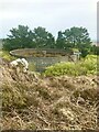
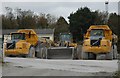
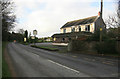
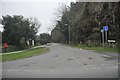
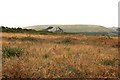

12 photos from this area
Area Information
Key information about the PL26 7TE including its size, population, and administrative classification.
- Area Type
- Postcode
- Area Size
- 33.0 hectares
- Population
- 1589
- Population Density
- 211 people/km²
House Prices in PL26 7TE
16
Properties
£135,333
Average Sold Price
£30,000
Lowest Price
£287,000
Highest Price
Showing 16 properties
| Address | Type | Beds | Baths | Last Sale Price | Last Sale Date | |
|---|---|---|---|---|---|---|
| Blackpool House, A 3058 Between Long Lane And Tremewan, High Street, PL26 7TE | house | - | - | £287,000 | Feb 2016 | |
| Esquimalt, A 3058 Between Long Lane And Tremewan, High Street, PL26 7TE | Detached | - | - | £89,000 | Jun 2001 | |
| Prideaux Cottage, Penisker Road, High Street, PL26 7TE | Detached | 2 | - | £30,000 | Jul 1997 | |
| 3, Prideaux, A 3058 Between Long Lane And Tremewan, High Street, PL26 7TE | Detached | 5 | - | - | - | |
| Caravan For Construction Of Wiltons Way, A 3058 Between Long Lane And Tremewan, High Street, PL26 7TE | Mobile Home | - | - | - | - | |
| Gra Maur, A 3058 Between Long Lane And Tremewan, High Street, PL26 7TE | Terraced | - | - | - | - | |
| Wiltons Way, A 3058 Between Long Lane And Tremewan, High Street, PL26 7TE | house | - | - | - | - | |
| Caravan For Build Of The Old Mill, Lane From Valpre To A 3058 At Newgate, High Street, PL26 7TE | Mobile Home | - | - | - | - | |
| Tre An Lodge, A 3058 Between Long Lane And Tremewan, High Street, PL26 7TE | Detached | - | - | - | - | |
| 4, Prideaux, A 3058 Between Long Lane And Tremewan, High Street, PL26 7TE | house | - | - | - | - |
Page 1 of 2
Energy Efficiency in PL26 7TE
Amenities
Schools
| Rank | School | Type | Entry gender | Ages |
|---|
Explore more schools in this area
Go to Schools tabDemographics
Household Size
Two person
most common
Accommodation Type
Houses
most common
Tenure
78
majority
Ethnic Group
White
most common
Religion
N/A
most common
Household Composition
N/A
most common
Age
47
median
Adults (30-64 years)
most common
Household Deprivation
N/A
with no deprivation
NS-SEC
28
in Lower managerial occupations
Explore more demographic insights in this area
Go to Demographics tabPlanning
Planning Constraints
- Flood RiskPremium
- Ramsar Wetland SitesPremium
- Area of Outstanding Natural BeautyPremium
- Protected Nature ReservePremium
- Protected WoodlandPremium