Area Overview for PL25 5TF
Photos of PL25 5TF
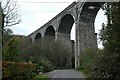
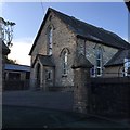
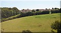
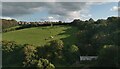
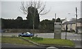
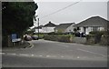
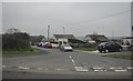

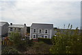
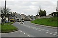
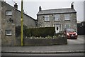
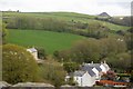
15 photos from this area
Area Information
Key information about the PL25 5TF including its size, population, and administrative classification.
- Area Type
- Postcode
- Area Size
- 2.5 hectares
- Population
- 1589
- Population Density
- 211 people/km²
House Prices in PL25 5TF
19
Properties
£251,895
Average Sold Price
£105,000
Lowest Price
£432,000
Highest Price
Showing 19 properties
| Address | Type | Beds | Baths | Last Sale Price | Last Sale Date | |
|---|---|---|---|---|---|---|
| Buddleia Cottage, 20 Westbridge Road, Trewoon, PL25 5TF | Cottage | 3 | 1 | £350,000 | Mar 2025 | |
| 26 Westbridge Road, Trewoon, PL25 5TF | Detached | 4 | 2 | £390,000 | Jan 2025 | |
| Lowlands, 16 Westbridge Road, Trewoon, PL25 5TF | Detached | 3 | 2 | £432,000 | Jun 2022 | |
| 21 Westbridge Road, Trewoon, PL25 5TF | Detached | 3 | - | £295,000 | Dec 2018 | |
| Cles Penty, 22 Westbridge Road, Trewoon, PL25 5TF | Cottage | 2 | - | £119,950 | Apr 2018 | |
| 25 Westbridge Road, Trewoon, PL25 5TF | Cottage | 2 | 1 | £137,000 | Apr 2017 | |
| 28 Westbridge Road, Trewoon, PL25 5TF | Bungalow | 4 | 2 | £265,000 | Dec 2014 | |
| Carn Lea, 18 Westbridge Road, Trewoon, PL25 5TF | Semi-detached | - | - | £280,000 | May 2006 | |
| 24 Westbridge Road, Trewoon, PL25 5TF | Semi-detached | 2 | 2 | £145,000 | Oct 2004 | |
| 31 Westbridge Road, Trewoon, PL25 5TF | Detached | - | - | £105,000 | Feb 2002 |
Page 1 of 2
Energy Efficiency in PL25 5TF
Amenities
Schools
| Rank | School | Type | Entry gender | Ages |
|---|
Explore more schools in this area
Go to Schools tabDemographics
Household Size
Two person
most common
Accommodation Type
Houses
most common
Tenure
78
majority
Ethnic Group
White
most common
Religion
N/A
most common
Household Composition
N/A
most common
Age
47
median
Adults (30-64 years)
most common
Household Deprivation
N/A
with no deprivation
NS-SEC
28
in Lower managerial occupations
Explore more demographic insights in this area
Go to Demographics tabPlanning
Planning Constraints
- Flood RiskPremium
- Ramsar Wetland SitesPremium
- Area of Outstanding Natural BeautyPremium
- Protected Nature ReservePremium
- Protected WoodlandPremium