Area Overview for PL25 4UU
Photos of PL25 4UU

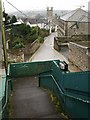
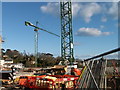

100 photos from this area
Area Information
Key information about the PL25 4UU including its size, population, and administrative classification.
- Area Type
- Postcode
- Area Size
- 2.7 hectares
- Population
- 1895
- Population Density
- 4510 people/km²
House Prices in PL25 4UU
26
Properties
£290,225
Average Sold Price
£215,000
Lowest Price
£550,000
Highest Price
Showing 26 properties
| Address | Type | Beds | Baths | Last Sale Price | Last Sale Date | |
|---|---|---|---|---|---|---|
| The Haven, 31 Trelevan Close, St Austell, PL25 4UU | Detached | 4 | 2 | £437,000 | Jan 2023 | |
| 14 Trelevan Close, St Austell, PL25 4UU | Detached | 4 | 2 | £550,000 | Jul 2022 | |
| 7 Trelevan Close, St Austell, PL25 4UU | Detached | 4 | 2 | £350,000 | Feb 2020 | |
| 1 Trelevan Close, St Austell, PL25 4UU | Detached | 4 | - | £296,000 | Dec 2016 | |
| 30 Trelevan Close, St Austell, PL25 4UU | Detached | 3 | - | £305,000 | Jun 2016 | |
| 8 Trelevan Close, St Austell, PL25 4UU | Detached | 4 | - | £290,000 | May 2016 | |
| 6 Trelevan Close, St Austell, PL25 4UU | Detached | 4 | 2 | £244,000 | Oct 2015 | |
| 5 Trelevan Close, St Austell, PL25 4UU | Detached | 4 | - | £215,000 | Sep 2015 | |
| 2 Trelevan Close, St Austell, PL25 4UU | Detached | 4 | - | £270,000 | May 2014 | |
| 18 Trelevan Close, St Austell, PL25 4UU | Detached | 4 | - | £249,950 | Mar 2014 |
Page 1 of 3
Energy Efficiency in PL25 4UU
Amenities
Schools
| Rank | School | Type | Entry gender | Ages |
|---|
Explore more schools in this area
Go to Schools tabDemographics
Household Size
One person
most common
Accommodation Type
Houses
most common
Tenure
40
majority
Ethnic Group
White
most common
Religion
N/A
most common
Household Composition
N/A
most common
Age
47
median
Adults (30-64 years)
most common
Household Deprivation
N/A
with no deprivation
NS-SEC
21
in Lower managerial occupations
Explore more demographic insights in this area
Go to Demographics tabPlanning
Planning Constraints
- Flood RiskPremium
- Ramsar Wetland SitesPremium
- Area of Outstanding Natural BeautyPremium
- Protected Nature ReservePremium
- Protected WoodlandPremium