Area Overview for PL25 4EW
Photos of PL25 4EW


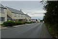
29 photos from this area
Area Information
Key information about the PL25 4EW including its size, population, and administrative classification.
- Area Type
- Postcode
- Area Size
- 9.5 hectares
- Population
- 2707
- Population Density
- 1959 people/km²
House Prices in PL25 4EW
38
Properties
£188,521
Average Sold Price
£60,000
Lowest Price
£400,000
Highest Price
Showing 38 properties
| Address | Type | Beds | Baths | Last Sale Price | Last Sale Date | |
|---|---|---|---|---|---|---|
| 3, Evergreen Cottages, Treverbyn Road, St Austell, PL25 4EW | Terraced | 4 | 1 | £252,500 | Sep 2024 | |
| 78A Treverbyn Road, St Austell, PL25 4EW | house | 3 | 2 | £95,000 | Sep 2024 | |
| 68 Treverbyn Road, St Austell, PL25 4EW | Semi-detached | 4 | 1 | £310,000 | Oct 2023 | |
| 60 Treverbyn Road, St Austell, PL25 4EW | Terraced | 3 | 1 | £136,000 | Sep 2023 | |
| The Bungalow, 71A Treverbyn Road, St Austell, PL25 4EW | Bungalow | 3 | 1 | £200,000 | Jul 2020 | |
| Highfield, Treverbyn Road, St Austell, PL25 4EW | Bungalow | - | - | £100,000 | Jul 2020 | |
| Fernleigh, 82 Treverbyn Road, St Austell, PL25 4EW | Semi-detached | 4 | - | £230,000 | Feb 2020 | |
| 73 Treverbyn Road, St Austell, PL25 4EW | Terraced | 2 | 1 | £112,500 | Jan 2020 | |
| 75 Treverbyn Road, St Austell, PL25 4EW | Terraced | 2 | 2 | £130,000 | Aug 2019 | |
| 66 Treverbyn Road, St Austell, PL25 4EW | Semi-detached | 2 | 1 | £174,000 | Dec 2017 |
Page 1 of 4
Energy Efficiency in PL25 4EW
Amenities
Schools
| Rank | School | Type | Entry gender | Ages |
|---|
Explore more schools in this area
Go to Schools tabDemographics
Household Size
Two person
most common
Accommodation Type
Houses
most common
Tenure
72
majority
Ethnic Group
White
most common
Religion
N/A
most common
Household Composition
N/A
most common
Age
47
median
Adults (30-64 years)
most common
Household Deprivation
N/A
with no deprivation
NS-SEC
27
in Lower managerial occupations
Explore more demographic insights in this area
Go to Demographics tabPlanning
Planning Constraints
- Flood RiskPremium
- Ramsar Wetland SitesPremium
- Area of Outstanding Natural BeautyPremium
- Protected Nature ReservePremium
- Protected WoodlandPremium