Area Overview for PL25 3TA
Photos of PL25 3TA

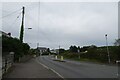
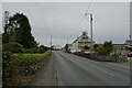
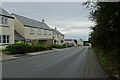
29 photos from this area
Area Information
Key information about the PL25 3TA including its size, population, and administrative classification.
- Area Type
- Postcode
- Area Size
- 5.0 hectares
- Population
- 2707
- Population Density
- 1959 people/km²
House Prices in PL25 3TA
35
Properties
£312,526
Average Sold Price
£53,000
Lowest Price
£690,000
Highest Price
Showing 35 properties
| Address | Type | Beds | Baths | Last Sale Price | Last Sale Date | |
|---|---|---|---|---|---|---|
| Tanamara, Carclaze Road, St Austell, PL25 3TA | Detached | 5 | 3 | £690,000 | Dec 2024 | |
| Four Winds, Carclaze Road, St Austell, PL25 3TA | Detached | 3 | 2 | £300,000 | Mar 2024 | |
| Pell-meor, Carclaze Road, St Austell, PL25 3TA | Retail | 4 | 3 | £485,000 | Oct 2022 | |
| Hillside, Carclaze Road, St Austell, PL25 3TA | house | - | - | £332,500 | Mar 2021 | |
| Lowenva, Carclaze Road, St Austell, PL25 3TA | Bungalow | - | - | £465,000 | Nov 2020 | |
| Ferndown, Carclaze Road, St Austell, PL25 3TA | Bungalow | 4 | 2 | £365,000 | Jan 2019 | |
| Kernow Veor, Carclaze Road, St Austell, PL25 3TA | Detached | 4 | - | £385,000 | Jan 2017 | |
| Trebart, Carclaze Road, St Austell, PL25 3TA | Detached | 3 | - | £299,500 | Jun 2016 | |
| Rockleigh, Carclaze Road, St Austell, PL25 3TA | Detached | 5 | - | £320,000 | Apr 2016 | |
| Sunstone, Carclaze Road, St Austell, PL25 3TA | Detached | 3 | 2 | £235,000 | Oct 2014 |
Page 1 of 4
Energy Efficiency in PL25 3TA
Amenities
Schools
| Rank | School | Type | Entry gender | Ages |
|---|
Explore more schools in this area
Go to Schools tabDemographics
Household Size
Two person
most common
Accommodation Type
Houses
most common
Tenure
72
majority
Ethnic Group
White
most common
Religion
N/A
most common
Household Composition
N/A
most common
Age
47
median
Adults (30-64 years)
most common
Household Deprivation
N/A
with no deprivation
NS-SEC
27
in Lower managerial occupations
Explore more demographic insights in this area
Go to Demographics tabPlanning
Planning Constraints
- Flood RiskPremium
- Ramsar Wetland SitesPremium
- Area of Outstanding Natural BeautyPremium
- Protected Nature ReservePremium
- Protected WoodlandPremium