Area Overview for PL25 3BY
Photos of PL25 3BY
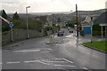
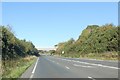
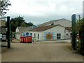
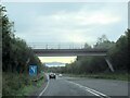
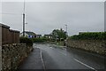
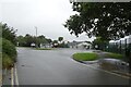
20 photos from this area
Area Information
Key information about the PL25 3BY including its size, population, and administrative classification.
- Area Type
- Postcode
- Area Size
- 3.3 hectares
- Population
- 2087
- Population Density
- 2620 people/km²
House Prices in PL25 3BY
41
Properties
£214,096
Average Sold Price
£103,995
Lowest Price
£370,000
Highest Price
Showing 41 properties
| Address | Type | Beds | Baths | Last Sale Price | Last Sale Date | |
|---|---|---|---|---|---|---|
| 72 Retallick Meadows, St Austell, PL25 3BY | Semi-detached | 3 | - | £250,000 | Oct 2022 | |
| 54 Retallick Meadows, St Austell, PL25 3BY | house | - | - | £290,000 | Jun 2021 | |
| 80 Retallick Meadows, St Austell, PL25 3BY | house | - | - | £320,000 | Jun 2021 | |
| 63 Retallick Meadows, St Austell, PL25 3BY | house | - | - | £350,000 | Mar 2021 | |
| 52 Retallick Meadows, St Austell, PL25 3BY | house | - | - | £325,000 | Oct 2020 | |
| 70 Retallick Meadows, St Austell, PL25 3BY | Detached | 3 | 2 | £226,000 | Sep 2020 | |
| 55 Retallick Meadows, St Austell, PL25 3BY | Detached | 4 | 2 | £295,000 | Jun 2020 | |
| 61 Retallick Meadows, St Austell, PL25 3BY | Detached | 5 | 2 | £370,000 | Feb 2020 | |
| 66 Retallick Meadows, St Austell, PL25 3BY | Detached | 4 | 1 | £245,000 | Nov 2018 | |
| 59 Retallick Meadows, St Austell, PL25 3BY | Detached | 4 | - | £235,000 | Oct 2017 |
Page 1 of 5
Energy Efficiency in PL25 3BY
Amenities
Schools
| Rank | School | Type | Entry gender | Ages |
|---|
Explore more schools in this area
Go to Schools tabDemographics
Household Size
Two person
most common
Accommodation Type
Houses
most common
Tenure
68
majority
Ethnic Group
White
most common
Religion
N/A
most common
Household Composition
N/A
most common
Age
47
median
Adults (30-64 years)
most common
Household Deprivation
N/A
with no deprivation
NS-SEC
26
in Lower managerial occupations
Explore more demographic insights in this area
Go to Demographics tabPlanning
Planning Constraints
- Flood RiskPremium
- Ramsar Wetland SitesPremium
- Area of Outstanding Natural BeautyPremium
- Protected Nature ReservePremium
- Protected WoodlandPremium