Area Overview for PL24 2JF
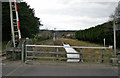
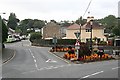
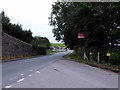
Photos of PL24 2JF


Area Information
Living in PL24 2JF offers a specific residential experience within a defined cluster of 1.1 hectares. The postcode area houses 1,866 people, creating a population density of 1,388 people per square kilometre. This sizeable density suggests a neighbourhood with built-in community interaction rather than isolated rural living. The location is situated in Cornwall, England, placing it within a region known for its distinct coastal character. Residents here navigate a compact environment where proximity to neighbours is inevitable. The area functions as a residential hub where daily life revolves around immediate local amenities rather than distant town centres. You can expect a setting that balances urban convenience with the geographical boundaries of a specific postcode zone. The concentration of people means that services are within walking or short driving distance. The character of PL24 2JF is defined by this tight-knit arrangement of homes and the surrounding infrastructure that supports such a population. It is a place where planning matters are closely monitored due to the land constraints. Buyers considering this location should understand the precise nature of the estate they are entering.
- Area Type
- Postcode
- Area Size
- 1.1 hectares
- Population
- 1866
- Population Density
- 1388 people/km²
The housing stock in PL24 2JF is overwhelmingly characterised by houses, with 69% of residents owning their properties outright or with a mortgage. This figure indicates a market where ownership is the norm rather than the exception. You will find very few private landladies managing rental portfolios within this specific postcode cluster. The predominance of houses means that the architecture and layout are suited for families or larger households rather than single professionals seeking apartments. Living in PL24 2JF typically involves purchasing a standalone property or part of a semi-detached pair. This low vacancy rate for rentals means that competition exists primarily among buyers not eventual tenants. The high ownership percentage often correlates with lower turnover and a grittier, more permanent residential fabric. When searching for homes in this area, you should anticipate buying from current owners who have lived there for years. The market dynamics suggest stability, with properties often staying on the market for extended periods if listed.
House Prices in PL24 2JF
Showing 6 properties
| Address | Type | Beds | Baths | Last Sale Price | Last Sale Date | |
|---|---|---|---|---|---|---|
| 6 Roselyon Place, Par, PL24 2JF | Bungalow | 3 | 1 | £225,000 | Sep 2018 | |
| 4 Roselyon Place, Par, PL24 2JF | Bungalow | 3 | 1 | £245,000 | Sep 2015 | |
| 5 Roselyon Place, Par, PL24 2JF | Bungalow | 3 | - | £230,000 | Jul 2012 | |
| 1 Roselyon Place, Par, PL24 2JF | Detached | - | - | £234,000 | May 2007 | |
| 2 Roselyon Place, Par, PL24 2JF | Detached | - | - | £75,750 | Sep 1997 | |
| 3 Roselyon Place, Par, PL24 2JF | Detached | 3 | 1 | - | - |
Energy Efficiency in PL24 2JF
Your daily life in PL24 2JF benefits from a range of amenities within practical reach. Five retail outlets serve the local population, including a Co-op on Station Street and two Spar locations. These hypermarkets and convenience stores mean you can buy groceries and essentials without leaving the immediate vicinity. Transport links are equally accessible, with five railway stations nearby, including Par, Luxulyan, and St Austell. These train stations provide connections to Plymouth and beyond for commuters or rail enthusiasts. Ferry options are also available, with landing points at Fowey Custom House Quay, Fowey Ferry Landing, and Fowey Town Quay. These water ferries offer a scenic route for travel or leisure. The mix of rail and ferry ensures you have multiple modes of transport for your journey. Shopping trips become quick errands rather than lengthy journeys to Cornwall's main cities. Dining and leisure are integrated into the broader local network accessible from this postcode. The convenience of these nearby services defines the practical rhythm of living here.
Amenities
Schools
| Rank | School | Type | Entry gender | Ages |
|---|
Explore more schools in this area
Go to Schools tabDemographics
The community profile of PL24 2JF reflects an established neighbourhood with a median age of 47 years. Adults aged between 30 and 64 years form the most common age range, indicating families or individuals in the middle of their working lives. A robust 69% of residents own their homes, which suggests a high level of local stability and investment in the property. Houses are the predominant form of accommodation, distinguishing this area from those dominated by high-rise flats or shared housing. The predominant ethnic group is White, aligning with the broader demographics of many historic English towns and villages. This demographic mixture creates a environment where long-term residents have likely shaped the local culture. The high home ownership rate implies that the property market is geared towards buyers establishing permanent residences rather than short-term renters. You are looking at a demographic where residents have deep roots in the locality. The age profile supports local businesses targeting mature consumers and families with school-aged children.
Household Size
Accommodation Type
Tenure
Ethnic Group
Religion
Household Composition
Age
Household Deprivation
NS-SEC
Explore more demographic insights in this area
Go to Demographics tabPlanning
Planning Constraints
- Flood RiskPremium
- Ramsar Wetland SitesPremium
- Area of Outstanding Natural BeautyPremium
- Protected Nature ReservePremium
- Protected WoodlandPremium