Area Overview for PL21 9UU
Photos of PL21 9UU
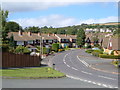
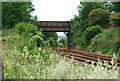
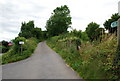
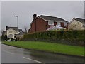
62 photos from this area
Area Information
Key information about the PL21 9UU including its size, population, and administrative classification.
- Area Type
- Postcode
- Area Size
- 1.3 hectares
- Population
- 1433
- Population Density
- 5737 people/km²
House Prices in PL21 9UU
43
Properties
£134,214
Average Sold Price
£22,500
Lowest Price
£327,000
Highest Price
Showing 43 properties
| Address | Type | Beds | Baths | Last Sale Price | Last Sale Date | |
|---|---|---|---|---|---|---|
| 16 Barn Close, Ivybridge, PL21 9UU | Terraced | 2 | 1 | £200,000 | Jul 2025 | |
| 29 Barn Close, Ivybridge, PL21 9UU | Terraced | 2 | 1 | £175,000 | Jun 2024 | |
| 32 Barn Close, Ivybridge, PL21 9UU | Detached | 3 | 1 | £327,000 | Feb 2024 | |
| 28 Barn Close, Ivybridge, PL21 9UU | Terraced | 2 | 1 | £197,000 | Mar 2023 | |
| Brambles, 4 Barn Close, Ivybridge, PL21 9UU | Terraced | 1 | 1 | £158,500 | Oct 2022 | |
| 3 Barn Close, Ivybridge, PL21 9UU | Terraced | 2 | 1 | £165,000 | Apr 2020 | |
| 35 Barn Close, Ivybridge, PL21 9UU | Terraced | 2 | 1 | £165,000 | Mar 2020 | |
| 31 Barn Close, Ivybridge, PL21 9UU | Terraced | 2 | 1 | £157,000 | Feb 2018 | |
| 27 Barn Close, Ivybridge, PL21 9UU | Terraced | 1 | 1 | £137,500 | Jul 2017 | |
| 21 Barn Close, Ivybridge, PL21 9UU | Terraced | 3 | 1 | £180,000 | Mar 2017 |
Page 1 of 5
Energy Efficiency in PL21 9UU
Amenities
Schools
| Rank | School | Type | Entry gender | Ages |
|---|
Explore more schools in this area
Go to Schools tabDemographics
Household Size
Two person
most common
Accommodation Type
Houses
most common
Tenure
73
majority
Ethnic Group
White
most common
Religion
N/A
most common
Household Composition
N/A
most common
Age
47
median
Adults (30-64 years)
most common
Household Deprivation
N/A
with no deprivation
NS-SEC
37
in Lower managerial occupations
Explore more demographic insights in this area
Go to Demographics tabPlanning
Planning Constraints
- Flood RiskPremium
- Ramsar Wetland SitesPremium
- Area of Outstanding Natural BeautyPremium
- Protected Nature ReservePremium
- Protected WoodlandPremium