Area Overview for PL21 0QP
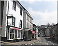
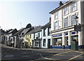
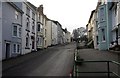
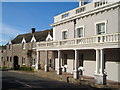
Photos of PL21 0QP


Area Information
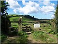
Living in PL21 0QP offers a quiet residential experience within Devon, characterised by a low-density environment. This specific postcode covers a small cluster comprising just 1857 square metres and serving a population of 2008 residents. With 85 people per square kilometre, you will find spacious surroundings rather than crowded streets. The area feels established yet tranquil, away from the direct noise of larger towns while remaining linked to Plymouth and surrounding villages. You will live in a setting where the pace of life is slower, defined more by natural quiet than by commercial activity. The community is tightly knit, with most neighbours likely to know one another after a short period of residence. You are looking at a location that values stability and peace over urban convenience or rapid development. Nearby landmarks and rural features shape the daily rhythm of life here. The small footprint of this cluster means you are not looking at a sprawling village, but a distinct residential pocket. This configuration suits those who prefer a brief commute to services while enjoying a sense of seclusion in their own home.
- Area Type
- Postcode
- Area Size
- 1857 m²
- Population
- 2008
- Population Density
- 85 people/km²
The property market in PL21 0QP is dominated by owner-occupiers, with 73% of homes held by those who buy rather than rent. This high ownership rate typically indicates a stable housing stock where tenants are scarce and landlords are rare in this specific cluster. Houses form the only accommodation type available, confirming that you will find single-family dwellings rather than apartments or communal living spaces. This structure appeals to buyers seeking privacy and dedicated garden space, though it limits options for those preferring shared amenities. The small area size of 1857 square metres means the total number of properties is limited, creating a tight local market. When buying homes in this postcode, expect to compete with other serious buyers willing to live in the same community for the long term. The lack of rental stock suggests that vacancies are uncommon and prices may reflect the scarcity of available properties. You are entering a market driven by genuine residence rather than speculative investment or short-term letting. This environment supports families looking for roots rather than commuters seeking a temporary hub.
House Prices in PL21 0QP
Showing 5 properties
| Address | Type | Beds | Baths | Last Sale Price | Last Sale Date | |
|---|---|---|---|---|---|---|
| 15 Church Street, Modbury, PL21 0QP | Terraced | 5 | 3 | £455,000 | Jan 2019 | |
| 17 Church Street, Modbury, PL21 0QP | Terraced | 5 | 1 | £230,000 | Jun 2016 | |
| Magnolia Cottage Rear Of 18, Church Street, Modbury, PL21 0QP | house | 4 | - | £112,000 | Apr 1999 | |
| 18 Church Street, Modbury, PL21 0QP | Maisonette | 1 | - | - | - | |
| 16 Church Street, Modbury, PL21 0QP | Semi-detached | 1 | 1 | - | - |
Energy Efficiency in PL21 0QP
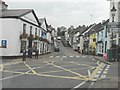
Your daily life in PL21 0QP revolves around a small selection of essential amenities located within practical reach. You have five retail options nearby, including Co-op Modbury, Spar, and the larger Co-op Ivybridge, ensuring you can buy groceries and essentials without driving far. For travel, Ivybridge Railway Station provides a single rail connection, offering a direct link to broader city networks. Water residents are also served by two ferry landings: Cockleridge Ham Ferry Landing and Bantham Ferry Landing. These ferries provide unique access to nearby coastal sites, adding a recreational element to your routine. The presence of these specific transport hubs means you can reach towns and coastlines quickly if needed. Shopping runs are straightforward thanks to the Supermarkets and Co-op branches. You do not have access to high fashion or boutique dining within the immediate cluster, but the named shops offer all standard daily needs. The combination of rail and ferry options creates a flexible travel network for weekends or occasional trips. Your lifestyle involves a mix of solitary home life and selective outward engagement with the wider county network.
Amenities
Schools
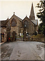
Families in PL21 0QP have access to Modbury Primary School, located nearby within practical reach. This institution is a primary school holding a Good rating from Ofsted. The single listing for schools suggests that this specific cluster is best suited for younger children, as there are no secondary schools listed within immediate proximity. You must consider travel time for older children needing middle and high school education outside this immediate radius. The Good rating from Ofsted for Modbury Primary School provides reassurance regarding educational standards for local toddlers and young students. This school serves the white-dominated demographic of the area, aligning with the regional educational landscape. Families with elementary school-aged children will find Modbury Primary School a reliable option for their educational needs. The proximity of this single school to the 2008 resident population means that many neighbours are likely sharing the same school gates. You should verify catchment areas directly if you plan to move your child to this institution. The absence of further details on specialist or secondary schools means you will rely on this primary option or private alternatives for early education.
| Rank | School | Type | Entry gender | Ages |
|---|
Explore more schools in this area
Go to Schools tabDemographics
The community in PL21 0QP centres on adults aged 30 to 64 years, with a median age of 47. This age profile suggests the area attracts families with young children and retirees who have down-sized from larger properties. Home ownership stands at a high 73%, indicating that most residents have a long-term stake in their local neighbourhood. You will find a stable population with deep roots rather than frequent transient residents or short-term tenants. The predominant ethnicity is White, reflecting the historic character of the county. Houses form the sole accommodation type in this postcode, meaning you will not encounter converted flats or purpose-built rental blocks. Deprivation levels are not highlighted in the available figures, but the high ownership rate implies financial security among the majority of households. This demographic mix creates a neighbourly environment where people tend to know each other well. The absence of young adults or school-aged children in the median calculation points to a mix of families and older couples. You are looking at a settled community where property values tend to remain steady due to strong locality ties.
Household Size
Accommodation Type
Tenure
Ethnic Group
Religion
Household Composition
Age
Household Deprivation
NS-SEC
Explore more demographic insights in this area
Go to Demographics tabPlanning
Planning Constraints
- Flood RiskPremium
- Ramsar Wetland SitesPremium
- Area of Outstanding Natural BeautyPremium
- Protected Nature ReservePremium
- Protected WoodlandPremium