Area Overview for PL20 7NU
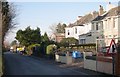
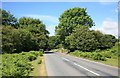
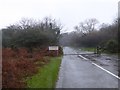
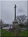
Photos of PL20 7NU


Area Information
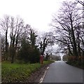
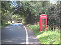
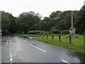
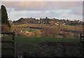
Living in the PL20 7NU postcode covers a specific residential cluster of just 2,768 square metres. This small footprint accommodates a population of 1,820 people, resulting in a low density of 146 inhabitants per square kilometre. The area functions as a quiet residential pocket rather than a bustling town centre. Its modest size means residents rely on the wider rural network for major services while enjoying a tranquil local environment. Daily life here revolves around a close-knit community where neighbours are often familiar faces. The low population density suggests a peaceful setting suitable for those seeking space and quiet. You will find that the area is defined by its housing stock rather than commercial development, creating a distinct sense of place. Prospective buyers looking at homes in PL20 7NU should understand that this postcode represents a very small geographic area. The community is established and stable, with most residents living year-round. If you value peace and proximity to nature over urban convenience, this postcode offers a quiet residential option. The scale of the area ensures that the local character remains intact without the crowds found in larger urban districts.
- Area Type
- Postcode
- Area Size
- 2768 m²
- Population
- 1820
- Population Density
- 146 people/km²
The property market in PL20 7NU is characterised by a strong owner-occupation culture. With 85 per cent of residents owning their homes, this is distinctly a settled neighbourhood rather than a transient rental market. This high ownership rate means that most households have either purchased or inherited their properties, indicating deep local roots. You will find fewer landlords or student renters compared to urban estates. The accommodation type data confirms that houses dominate the housing stock. This preference for houses over apartments or flats is typical of rural postcodes with older demographics. The prevalence of houses suggests that buying in PL20 7NU usually involves a family home or a retirement property rather than a flat. For buyers looking at this small area, the market reflects stability. There is little churn of tenants, which often leads to more consistent property values and less noise disruption from frequent turnover. When viewing properties, expect to be dealing with owner-occupiers who understand the local character. The housing supply is limited by the small physical size of the postcode, reinforcing the value of existing stock.
House Prices in PL20 7NU
Showing 14 properties
| Address | Type | Beds | Baths | Last Sale Price | Last Sale Date | |
|---|---|---|---|---|---|---|
| 7, Woodcroft, Road From Knighton To The Angle, Crapstone, PL20 7NU | Flat | 2 | 2 | £163,000 | Nov 2025 | |
| 6, Woodcroft, Road From Knighton To The Angle, Crapstone, PL20 7NU | Flat | - | - | £195,000 | Jun 2023 | |
| 1, Woodcroft, Road From Knighton To The Angle, Crapstone, PL20 7NU | Flat | - | - | £175,000 | Jun 2022 | |
| 5, Woodcroft, Road From Knighton To The Angle, Crapstone, PL20 7NU | Flat | - | - | £225,000 | Jan 2017 | |
| 4, Woodcroft, Road From Knighton To The Angle, Crapstone, PL20 7NU | Flat | - | - | £195,000 | Apr 2016 | |
| 9, Woodcroft, Road From Knighton To The Angle, Crapstone, PL20 7NU | Flat | - | - | £175,000 | Oct 2013 | |
| 2, Woodcroft, Road From Knighton To The Angle, Crapstone, PL20 7NU | Flat | - | - | £195,000 | Aug 2011 | |
| 3, Woodcroft, Road From Knighton To The Angle, Crapstone, PL20 7NU | Flat | 2 | 2 | £159,950 | Jan 2010 | |
| 8, Woodcroft, Road From Knighton To The Angle, Crapstone, PL20 7NU | Flat | - | - | £165,000 | Aug 2009 | |
| 12, Woodcroft, Road From Knighton To The Angle, Crapstone, PL20 7NU | Flat | 2 | 2 | - | - |
Energy Efficiency in PL20 7NU
Daily life in PL20 7NU benefits from convenient access to essential amenities within practical reach. Retail options include Co-op Yelverton, Spar Horrabridge, and Spar Whitchurch, which are among the nearest shops. These superstores offer the groceries and daily essentials most residents need without requiring a long drive. Travel to further destinations is facilitated by several rail stations nearby. Bere Alston Railway Station, Bere Ferrers Railway Station, and Calstock Railway Station are the notable rail hubs within easy reach. These stations provide connections to Cornish towns and potentially to Plymouth, expanding your travel options significantly. For air travel, Plymouth City Airport serves as the closest facility. This airport allows residents to bypass larger hubs like Exeter or London for certain domestic flights. The presence of two airport listings highlights the strategic location of the area relative to regional aviation. You can also enjoy the natural surroundings, which lie within an Area of Outstanding Natural Beauty. This designation protects the landscape and offers scenic views while restricting heavy industrial development in your vicinity.
Amenities
Schools
| Rank | School | Type | Entry gender | Ages |
|---|
Explore more schools in this area
Go to Schools tabDemographics
The community in PL20 7NU reflects a mature society with a median age of 47 years. Adults between the ages of 30 and 64 represent the most common age range within the population. This demographic profile indicates a neighbourhood dominated by established households rather than young professionals or students. You are likely to encounter families and empty nesters who have put down roots in the local homes. Home ownership stands at an impressive 85 per cent within this postcode. This high rate of ownership suggests financial stability among residents and a strong sense of attachment to the area. The accommodation type is primarily houses, offering detached or semi-detached properties rather than apartments or flats. This housing style aligns with the older demographic and the rural character of the surrounding region. The predominant ethnic group is White, mirroring the traditional demographic makeup of many rural English communities. With such a high ownership rate and stable age profile, the area feels like a settled community where long-term residents know their neighbours. Children generally do not live in homes in PL20 7NU in large numbers, reflecting the older age structure of the population.
Household Size
Accommodation Type
Tenure
Ethnic Group
Religion
Household Composition
Age
Household Deprivation
NS-SEC
Explore more demographic insights in this area
Go to Demographics tabPlanning
Planning Constraints
- Flood RiskPremium
- Ramsar Wetland SitesPremium
- Area of Outstanding Natural BeautyPremium
- Protected Nature ReservePremium
- Protected WoodlandPremium