Area Overview for PL20 6SA
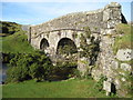
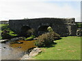
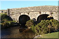
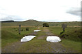
Photos of PL20 6SA


Area Information
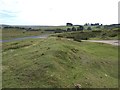
PL20 6SA represents a specific residential cluster situated within the broader Devon postcodes. This small area covers 15.3 square kilometres and supports a population of 2,107 residents. You will find a very tranquil setting here, characterised by low population density averaging just 10 people per square kilometre. Life in this postcode is defined by its quiet rural nature and spacious feel. The location sits comfortably within the PL20 region, offering a slice of country living for those seeking seclusion. You can expect a calm daily routine where community interactions happen at a slower pace. The environment provides a stark contrast to faster-paced urban centres, prioritising stability and access to green space over city conveniences. Residents value the roominess inherent to such a low density, allowing for spacious gardens and open views. While the area feels remote, it maintains a distinct identity as part of the local Devon landscape. Homebuyers choosing PL20 6SA are selecting a lifestyle defined by stillness and a clear connection to the surrounding countryside. This specific cluster remains a containment of homes that balances privacy with essential local access.
- Area Type
- Postcode
- Area Size
- 15.3 km²
- Population
- 2107
- Population Density
- 10 people/km²
The property market in PL20 6SA is defined by significant home ownership levels. You will find that 71% of homes in this area are owned outright or have a mortgage. This statistic highlights a market dominated by long-term residents rather than transient tenant populations. Houses make up the predominant accommodation type, meaning you will rarely encounter apartments or flats within this specific cluster. The high percentage of ownership suggests a stable housing stock where owners have deep roots in the community. For you as a buyer, this translates to a neighbourhood where property values tend to reflect investment in the physical home and land rather than rental yields. The market is not a rental hub, so vacancy rates are likely low and competition for older stock can occur. You are looking at a traditional housing stock where detached or semi-detached homes are the norm. The small size of the postcode means the entire market is compact and manageable without being oversized. Properties here cater to those who intend to stay put rather than those in temporary living situations.
House Prices in PL20 6SA
Showing 7 properties
Energy Efficiency in PL20 6SA
Amenities
Schools
Families choosing PL20 6SA will find reliable primary education options nearby. Lydford Primary School stands as a key educational facility offering primary education with a Ofsted rating of good. Additionally, Princetown Community Primary School serves the local area and also holds a good rating from Ofsted. These two institutions provide the main schooling options for children residing in the postcode. Both schools focus on early years through to the primary spectrum, meaning secondary education requires travel to larger centres. The fact that both local primaries hold good ratings indicates a standard of education that meets national expectations. You will not find state-of-the-art secondary schools directly embedded within this small cluster, but the primary catchment area is supportive. The availability of two good-rated primaries gives families choice if their address boundaries allow. This mix ensures that children can access solid foundational education without excessive travel distances in their early academic years.
| Rank | School | Type | Entry gender | Ages |
|---|
Explore more schools in this area
Go to Schools tabDemographics
The community within PL20 6SA reflects a settled, mature population. You will encounter a median age of 47 years, indicating that most residents fall into the 30 to 64 years range. This age profile suggests families and long-term residents rather than students or transient workers. Seventy-one percent of households own their homes, creating a stable, owner-occupied neighbourhood. The remaining accommodation leans heavily towards houses, presenting a uniform housing style across the postcodes. You will find little diversity in terms of ethnicity, with White residents forming the predominant group. This demographic consistency often breeds a strong sense of familiarity and established neighbourly ties. The area does not attract a young professional millennial crowd or a share-house demographic. Instead, you see established families and retirees who have made a lasting commitment to the location. The high home ownership rate means that changes to the local housing stock occur rarely. Prospective buyers can expect to mingle with neighbours who have likely lived in the area for decades. This stability is a key feature for anyone considering PL20 6SA.
Household Size
Accommodation Type
Tenure
Ethnic Group
Religion
Household Composition
Age
Household Deprivation
NS-SEC
Explore more demographic insights in this area
Go to Demographics tabPlanning
Planning Constraints
- Flood RiskPremium
- Ramsar Wetland SitesPremium
- Area of Outstanding Natural BeautyPremium
- Protected Nature ReservePremium
- Protected WoodlandPremium