Area Overview for PL20 6RA
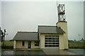
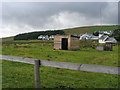
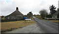
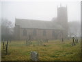
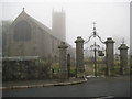
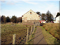
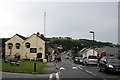
Photos of PL20 6RA


Area Information
This postcode covers a small residential cluster with a total area of 5,604 square metres. The community is characterised by significant space, as the low population density stands at only 10 people per square kilometre. With 2,107 residents within this compact zone, life here feels quiet and private rather than urban or crowded. The location appeals to those seeking a neighbourhood defined by open sky and reduced noise levels. Properties in this area benefit from a setting that feels detached and spacious despite the proximity to nearby settlements. Living in PL20 6RA means enjoying an environment where the close quarters do not translate to high-density living. The small geographic footprint ensures that neighbours are likely within short striking distance, fostering a sense of local familiarity without the constraints of a bustling town centre. You will find a setting where privacy remains a priority, distinct from the typical row-house environment found in larger urban districts.
- Area Type
- Postcode
- Area Size
- 5604 m²
- Population
- 2107
- Population Density
- 10 people/km²
The housing market in PL20 6RA is defined by a predominance of owner-occupied homes. Data confirms that 71% of the population owns their residence, which signals a mature market where sales are driven by inheritance, move-ups, or builds rather than high levels of entry-level renting. The entire accommodation stock consists of houses. There are no flats or apartments listed within this specific postcode area. This layout appeals to buyers seeking single-family homes with private gardens or detached isolation. The high ownership rate suggests that the supply of properties available to buy is consistent, though competition may be moderate due to the limited geographic size. For buyers looking at homes in PL20 6RA, the focus remains on traditional house types suitable for owner-occupiers. The lack of rental density means landlords rarely drive price fluctuations in this cluster. Each transaction typically involves a seller who has lived within this specific housing stock for a considerable time.
House Prices in PL20 6RA
Showing 6 properties
| Address | Type | Beds | Baths | Last Sale Price | Last Sale Date | |
|---|---|---|---|---|---|---|
| 2 Hessary View, Princetown, PL20 6RA | house | - | - | £180,000 | Oct 2020 | |
| 1 Hessary View, Princetown, PL20 6RA | Semi-detached | 3 | 1 | £170,000 | Nov 2019 | |
| 3 Hessary View, Princetown, PL20 6RA | Terraced | 3 | 2 | £140,000 | Aug 2017 | |
| 5 Hessary View, Princetown, PL20 6RA | Terraced | 3 | - | £94,000 | Oct 2012 | |
| 4 Hessary View, Princetown, PL20 6RA | house | 3 | - | £110,000 | Dec 2009 | |
| Mast Lodge, 1A Hessary View, Princetown, PL20 6RA | Detached | - | - | - | - |
Energy Efficiency in PL20 6RA
Residents of PL20 6RA benefit from practical access to retail amenities within a short travel radius. The nearest shops include Spar Horrabridge, Co-op Yelverton, and Spar Whitchurch. These three outlets form the core of daily shopping for necessities, covering groceries and essential household items. The distribution of these specific venues suggests a network established in nearby villages rather than a local high street immediately adjacent to every home. You would typically walk to one of these locations for routine purchases or use a car for slightly less frequent tasks. This arrangement provides convenience without requiring travel to large urban centres. The reliance on these specific convenience stores means that specialised retail options are not present within the immediate cluster. For a lifestyle focused on practical daily needs and avoiding large shopping centres, this setup is efficient. The presence of seasonal variety across these shops supports a low-key weekly routine centred around local village stores.
Amenities
Schools
Families living in PL20 6RA have access to primary education options nearby without secondary schools listed within immediate proximity. The nearest institutions include Lydford Primary School and Princetown Community Primary School. Both schools operate at a primary level. Lydford Primary School holds a 'good' Ofsted rating, indicating a standard of education that meets Examiners' expectations for teaching and safeguarding. Princetown Community Primary School also carries a 'good' Ofsted rating. This consistency in performance suggests a reliable education provision for young children in the area. The mix of named primary schools offers specific choices rather than a single catchment institution. While the absence of a listed secondary school in this specific dataset implies residents travel to outside locations for older children, the primary provision is stable. You have two distinct schools to consider if you are moving to this postcode for school-aged children.
| Rank | School | Type | Entry gender | Ages |
|---|
Explore more schools in this area
Go to Schools tabDemographics
The community in PL20 6RA reflects a settled population with a median age of 47 years. Age data shows that adults between 30 and 64 years represent the most common demographic group. This age profile suggests a neighbourhood dominated by established households rather than young families or elderly retirees living alone. Home ownership is high, with 71% of residents owning their property. This figure indicates a stable community where most people have put down roots rather than renting temporarily. Accommodation types are exclusively houses, confirming a traditional suburban or rural housing stock without flats or apartments. The predominant ethnic group is White, aligning with broader national patterns in many parts of the UK. This homogeneity often correlates with the high rate of home ownership, as long-term residents have historically settled in this specific type of housing. You are dealing with a community where ownership stability drives the social fabric and housing demand.
Household Size
Accommodation Type
Tenure
Ethnic Group
Religion
Household Composition
Age
Household Deprivation
NS-SEC
Explore more demographic insights in this area
Go to Demographics tabPlanning
Planning Constraints
- Flood RiskPremium
- Ramsar Wetland SitesPremium
- Area of Outstanding Natural BeautyPremium
- Protected Nature ReservePremium
- Protected WoodlandPremium