Area Overview for PL20 6DN
Photos of PL20 6DN
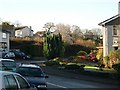
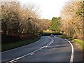
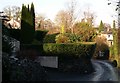
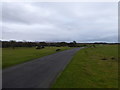
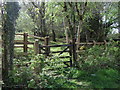
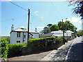
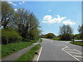
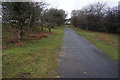
22 photos from this area
Area Information
Key information about the PL20 6DN including its size, population, and administrative classification.
- Area Type
- Postcode
- Area Size
- 1.2 hectares
- Population
- 1613
- Population Density
- 121 people/km²
House Prices in PL20 6DN
14
Properties
£277,583
Average Sold Price
£171,000
Lowest Price
£380,000
Highest Price
Showing 14 properties
| Address | Type | Beds | Baths | Last Sale Price | Last Sale Date | |
|---|---|---|---|---|---|---|
| Lancarffe, Devon Tors Road, Yelverton, PL20 6DN | Bungalow | 3 | 2 | £292,000 | Mar 2016 | |
| Cerrito, Devon Tors Road, Yelverton, PL20 6DN | Bungalow | 3 | 2 | £375,000 | Jul 2015 | |
| Shale, Devon Tors Road, Yelverton, PL20 6DN | Bungalow | 3 | 2 | £380,000 | Jun 2015 | |
| Torcot, Devon Tors Road, Yelverton, PL20 6DN | Bungalow | - | - | £222,500 | Nov 2009 | |
| Little Garth, Devon Tors Road, Yelverton, PL20 6DN | Bungalow | 3 | - | £225,000 | May 2006 | |
| Lanhadron, Devon Tors Road, Yelverton, PL20 6DN | Bungalow | 3 | 1 | £171,000 | Mar 2002 | |
| Christmas Cottage, Devon Tors Road, Yelverton, PL20 6DN | house | 5 | - | - | - | |
| Altarnum, Devon Tors Road, Yelverton, PL20 6DN | Detached | - | - | - | - | |
| Torcroft, Devon Tors Road, Yelverton, PL20 6DN | Detached | - | - | - | - | |
| 2 Devon Tors Road, Yelverton, PL20 6DN | Detached | - | - | - | - |
Page 1 of 2
Energy Efficiency in PL20 6DN
Amenities
Schools
| Rank | School | Type | Entry gender | Ages |
|---|
Explore more schools in this area
Go to Schools tabDemographics
Household Size
Two person
most common
Accommodation Type
Houses
most common
Tenure
66
majority
Ethnic Group
White
most common
Religion
N/A
most common
Household Composition
N/A
most common
Age
47
median
Adults (30-64 years)
most common
Household Deprivation
N/A
with no deprivation
NS-SEC
41
in Lower managerial occupations
Explore more demographic insights in this area
Go to Demographics tabPlanning
Planning Constraints
- Flood RiskPremium
- Ramsar Wetland SitesPremium
- Area of Outstanding Natural BeautyPremium
- Protected Nature ReservePremium
- Protected WoodlandPremium