Area Overview for PL2 2DW
Photos of PL2 2DW

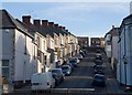
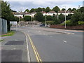
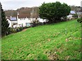
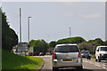
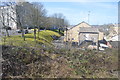
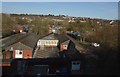
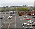
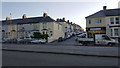
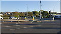
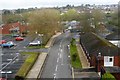
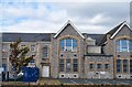
64 photos from this area
Area Information
Key information about the PL2 2DW including its size, population, and administrative classification.
- Area Type
- Postcode
- Area Size
- 11.6 hectares
- Population
- 1047
- Population Density
- 2774 people/km²
House Prices in PL2 2DW
52
Properties
£102,333
Average Sold Price
£30,000
Lowest Price
£235,000
Highest Price
Showing 52 properties
| Address | Type | Beds | Baths | Last Sale Price | Last Sale Date | |
|---|---|---|---|---|---|---|
| 22 Wombwell Crescent, Plymouth, PL2 2DW | house | 3 | 1 | £208,000 | Sep 2023 | |
| 13 Wombwell Crescent, Plymouth, PL2 2DW | house | 3 | 1 | £235,000 | Aug 2023 | |
| 45 Wombwell Crescent, Plymouth, PL2 2DW | Semi-detached | 3 | 1 | £153,000 | Nov 2018 | |
| 1 Wombwell Crescent, Plymouth, PL2 2DW | Terraced | 3 | 1 | £160,000 | Mar 2017 | |
| 5 Wombwell Crescent, Plymouth, PL2 2DW | Detached | 3 | 1 | £159,950 | Dec 2014 | |
| 44 Wombwell Crescent, Plymouth, PL2 2DW | Terraced | 3 | - | £155,000 | Apr 2014 | |
| 23 Wombwell Crescent, Plymouth, PL2 2DW | house | - | - | £125,000 | Nov 2013 | |
| 47 Wombwell Crescent, Plymouth, PL2 2DW | Terraced | 3 | - | £115,000 | Oct 2013 | |
| 3 Wombwell Crescent, Plymouth, PL2 2DW | house | - | - | £133,000 | Sep 2013 | |
| 11 Wombwell Crescent, Plymouth, PL2 2DW | Terraced | 3 | 1 | £110,000 | Mar 2013 |
Page 1 of 6
Energy Efficiency in PL2 2DW
Amenities
Schools
| Rank | School | Type | Entry gender | Ages |
|---|
Explore more schools in this area
Go to Schools tabDemographics
Household Size
Two person
most common
Accommodation Type
Houses
most common
Tenure
56
majority
Ethnic Group
White
most common
Religion
N/A
most common
Household Composition
N/A
most common
Age
47
median
Adults (30-64 years)
most common
Household Deprivation
N/A
with no deprivation
NS-SEC
22
in Lower managerial occupations
Explore more demographic insights in this area
Go to Demographics tabPlanning
Planning Constraints
- Flood RiskPremium
- Ramsar Wetland SitesPremium
- Area of Outstanding Natural BeautyPremium
- Protected Nature ReservePremium
- Protected WoodlandPremium