Area Overview for PL2 2DL
Photos of PL2 2DL
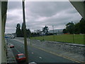
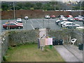
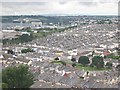
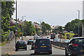
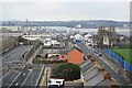
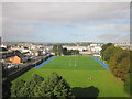
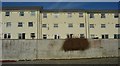
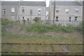

97 photos from this area
Area Information
Key information about the PL2 2DL including its size, population, and administrative classification.
- Area Type
- Postcode
- Area Size
- 1.1 hectares
- Population
- 1524
- Population Density
- 5349 people/km²
House Prices in PL2 2DL
33
Properties
£119,489
Average Sold Price
£37,500
Lowest Price
£270,000
Highest Price
Showing 33 properties
| Address | Type | Beds | Baths | Last Sale Price | Last Sale Date | |
|---|---|---|---|---|---|---|
| 78 Ocean Street, Plymouth, PL2 2DL | Terraced | 3 | 1 | £227,000 | Sep 2024 | |
| 74 Ocean Street, Plymouth, PL2 2DL | Terraced | 3 | 2 | £198,000 | Jun 2023 | |
| 58-60 Ocean Street, Plymouth, PL2 2DL | house | 6 | 2 | £270,000 | Feb 2023 | |
| 75 Ocean Street, Plymouth, PL2 2DL | Terraced | 3 | 1 | £142,000 | Nov 2018 | |
| 80 Ocean Street, Plymouth, PL2 2DL | Terraced | 3 | 1 | £145,000 | Aug 2018 | |
| 85 Ocean Street, Plymouth, PL2 2DL | Terraced | 4 | 1 | £159,000 | Oct 2016 | |
| 67 Ocean Street, Plymouth, PL2 2DL | Terraced | 3 | 2 | £151,300 | Jul 2016 | |
| 91 Ocean Street, Plymouth, PL2 2DL | Terraced | 3 | - | £125,000 | Jan 2014 | |
| 79 Ocean Street, Plymouth, PL2 2DL | house | - | - | £98,000 | Jul 2012 | |
| 70 Ocean Street, Plymouth, PL2 2DL | house | 3 | - | £94,000 | Aug 2011 |
Page 1 of 4
Energy Efficiency in PL2 2DL
Amenities
Schools
| Rank | School | Type | Entry gender | Ages |
|---|
Explore more schools in this area
Go to Schools tabDemographics
Household Size
Family (3-5 people)
most common
Accommodation Type
Houses
most common
Tenure
47
majority
Ethnic Group
White
most common
Religion
N/A
most common
Household Composition
N/A
most common
Age
47
median
Adults (30-64 years)
most common
Household Deprivation
N/A
with no deprivation
NS-SEC
17
in Lower managerial occupations
Explore more demographic insights in this area
Go to Demographics tabPlanning
Planning Constraints
- Flood RiskPremium
- Ramsar Wetland SitesPremium
- Area of Outstanding Natural BeautyPremium
- Protected Nature ReservePremium
- Protected WoodlandPremium