Area Overview for PL2 2BT
Photos of PL2 2BT
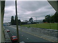
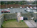
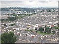
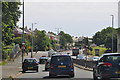
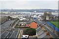
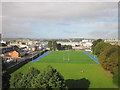
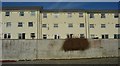
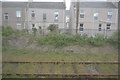
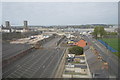
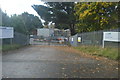
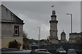

97 photos from this area
Area Information
Key information about the PL2 2BT including its size, population, and administrative classification.
- Area Type
- Postcode
- Area Size
- 7095 m²
- Population
- 1652
- Population Density
- 2089 people/km²
House Prices in PL2 2BT
38
Properties
£121,096
Average Sold Price
£45,000
Lowest Price
£200,000
Highest Price
Showing 38 properties
| Address | Type | Beds | Baths | Last Sale Price | Last Sale Date | |
|---|---|---|---|---|---|---|
| 133 Fleet Street, Plymouth, PL2 2BT | Terraced | 3 | - | £200,000 | Aug 2025 | |
| 121 Fleet Street, Plymouth, PL2 2BT | Terraced | 2 | 1 | £175,000 | Jul 2025 | |
| 123 Fleet Street, Plymouth, PL2 2BT | Terraced | 3 | 1 | £170,000 | Oct 2023 | |
| 118 Fleet Street, Plymouth, PL2 2BT | Terraced | 2 | 1 | £151,000 | Sep 2023 | |
| 126 Fleet Street, Plymouth, PL2 2BT | Terraced | 2 | 1 | £150,000 | Jan 2023 | |
| 134 Fleet Street, Plymouth, PL2 2BT | house | 3 | 1 | £170,000 | Jul 2022 | |
| 152 Fleet Street, Plymouth, PL2 2BT | house | 2 | 1 | £148,000 | Apr 2022 | |
| 147 Fleet Street, Plymouth, PL2 2BT | Terraced | 3 | - | £147,000 | Sep 2021 | |
| 141 Fleet Street, Plymouth, PL2 2BT | house | 3 | 1 | £148,000 | Oct 2020 | |
| 149 Fleet Street, Plymouth, PL2 2BT | house | 3 | 1 | £145,000 | Oct 2017 |
Page 1 of 4
Energy Efficiency in PL2 2BT
Amenities
Schools
| Rank | School | Type | Entry gender | Ages |
|---|
Explore more schools in this area
Go to Schools tabDemographics
Household Size
Two person
most common
Accommodation Type
Houses
most common
Tenure
58
majority
Ethnic Group
White
most common
Religion
N/A
most common
Household Composition
N/A
most common
Age
47
median
Adults (30-64 years)
most common
Household Deprivation
N/A
with no deprivation
NS-SEC
28
in Lower managerial occupations
Explore more demographic insights in this area
Go to Demographics tabPlanning
Planning Constraints
- Flood RiskPremium
- Ramsar Wetland SitesPremium
- Area of Outstanding Natural BeautyPremium
- Protected Nature ReservePremium
- Protected WoodlandPremium